.
.
This trip, I had the opportunity to follow the group to visit Khao Kho and Phu Lom Lo. If you ask me how many times I've been to Khao Kho, I'd say that if I put up both hands, my fingers wouldn't be enough to count. What do I like about Khao Kho? I'd say that Khao Kho has good weather, a good atmosphere, and is the closest place to my home (Lopburi) to see the sea of mist. As for Phu Lom Lo, I've never been there before, but I've heard the name of this place for a long time. Phu Lom Lo

Let me briefly explain the history of "Khao Kho". Originally, Khao Kho was a communist territory, a red zone filled with battles from people with different political ideologies. Looking back to the period between 1968 and 1982, Khao Kho was considered an extremely dangerous territory. Ordinary people should not even come close to it. However, when the conflict ended, Khao Kho transformed from a battlefield into one of the most interesting tourist destinations in Phetchabun.
I left Lopburi in the late morning and arrived in Phetchabun in the afternoon. After filling my stomach with supplies, I headed to Khao Kho District. The group used the Ban Camp Sn route.
Before entering the camp, stop by to pay respects to the Buddha at Wat Phra That Pha Sorn Kaew for good luck.

I have been visiting this temple since the construction of the Phra That Pha Sorn Kaew pagoda began. Every time I visit Khao Kho, I never miss the opportunity to admire the beauty of this pagoda. I have witnessed its transformation with each visit.
The Pha Sorn Kaew area is surrounded by rugged mountains and a cave at the top of the peak. Villagers have seen a crystal ball floating in the sky and disappearing into the cave on the cliff. Locals believe it is a sacred relic, hence the name "Pha Sorn Kaew", which translates to "Cliff Hiding the Crystal Ball".

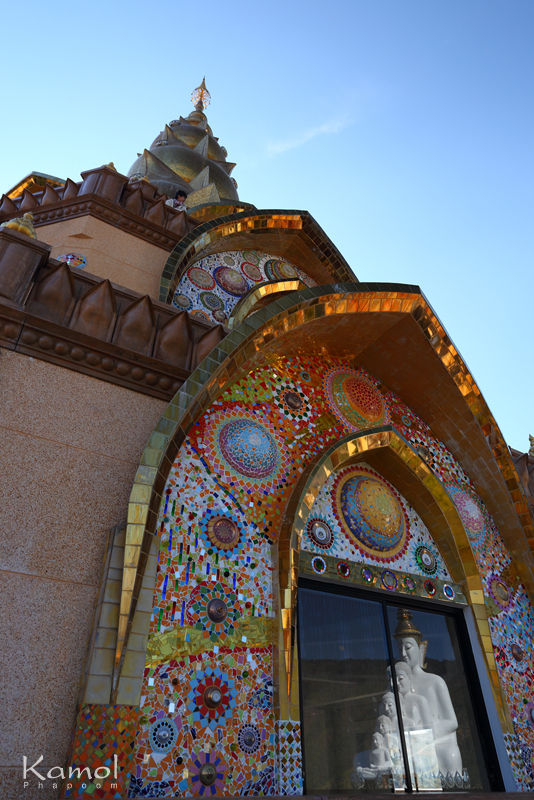
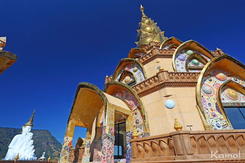
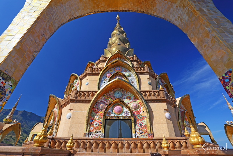
The Phra That Pha Sorn Kaew Si Racha Thammaramnit Chedi is designed to resemble a seven-layered lotus flower, a tribute to the Lord Buddha. The top of the chedi houses the relics of the Lord Buddha.


The Phra That Pha Son Kaew Chedi is beautifully designed, with colorful tiles from Benjarong porcelain, beads, glass rings, gold and silver, and other valuables used to decorate the chedi. This makes it incredibly beautiful and intricate, so much so that the Tourism Authority of Thailand (TAT) has listed it as one of the 10 Dream Destinations. It's a must-visit!

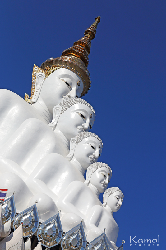
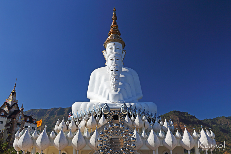
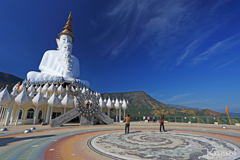
Turning your back to the Phra That Pha Sorn Kaew pagoda, on the left-hand side you will see the Satjaparamit building, the Thai-style accommodation huts, and the chanting hall. On the right-hand side, you will see the five Buddha statues. Currently, the construction of the front side has progressed significantly.


Visitors to this temple should dress modestly and take photos in an appropriate manner. Please maintain silence, avoid making loud noises, and refrain from entering areas where people are meditating. Help us keep the temple clean by not bringing pets inside. Most importantly, please look with your eyes and don't touch. If everyone touches the tiles used to decorate the stupa, it may cause the decorative materials to come loose and become damaged.
Then head to Khao Kho District. My first destination in Khao Kho is the Kanchanapisek Pagoda.


My next destination is to capture the last light at the Khao Kho Memorial. The distance from the Phra Borommathat Kanchanapisek Pagoda to the Memorial is about 10 kilometers. However, the road near the Memorial is quite steep, so we must drive carefully.

The scenery on both sides of the road from the Kanchanapisek Buddha Monthon to the Khao Kho Sacrificial Monument


From the Weaponry Museum at Itthi Base, it's not far to the Khao Kho Sacrificial Monument.

A large triangular marble obelisk stands tall on the mountaintop, built to remind all Thais that "Whenever Thais are in conflict, there will be a loss of brave lives, 1,171 of whom have been sacrificed to this monument. Let such an event never happen again."
The triangular shape is designed to have meaning according to its size and shape. The triangle represents the joint operation between civilians, police and military. The base of the monument is 11 meters wide, signifying the year 1968, the year the communist insurgency began in the Khao Kho area. The height from the altar to the top of the monument is 24 meters, signifying the year 1981, the year the major operation was launched. The height from the base to the top of the monument is 25 meters, signifying the year 1982, the year the armed conflict ended. The width of the base of each side of the triangle is 2.6 meters, signifying the year 1983, the year the construction of this monument to the fallen began.


Beside the Khao Kho Memorial, there is a replica of a battle base. It is a low hill with bunkers, sandbags, and trenches. In the past, this place was the first base that the Thai army recaptured from the Communist Party of Thailand.


This mock battleground also offers a stunning view of Khao Kho town, including the beautiful Kanchanapisek Pagoda.

It is also a great spot to watch the sunset.


The atmosphere after the sun has set, the last light begins to appear.


In the late evening, the weather was very cold, but I couldn't resist coming to see the constellations near the Rattanai Reservoir. Living in Lopburi, I don't have the opportunity to see the sky full of stars like this because there are so many lights. So I came here to endure the cold with a temperature of about 15 degrees Celsius.
Walking from the accommodation for less than 5 minutes, I saw that there was no fog around the Rattanai Reservoir, so I chose to capture the morning atmosphere at the reservoir instead. Because even if I went up to the viewpoint above, there would definitely be no fog to see. And besides, I have already been to see the sea of fog at the viewpoint before. But I have never been to capture the morning atmosphere by the reservoir, so I will just capture the cool view by the reservoir here.


This morning, I had rice porridge for breakfast. After the meal, I started my journey to my long-awaited destination: "Phu Lom Lo".
My group traveled via the Dan Sai route. Before reaching Dan Sai district, there will be a left turn at Ban Nam Phung. Keep turning left for about 19 km, and you will reach the entrance of Phu Hin Rong Kla National Park. The route is an asphalt road with some damage to the road surface. Some sections of the road are steep and alternate with flat sections.

From what I previously knew, there are 2 entrances to Phu Hin Rong Kla National Park: one from Nakhon Thai District and another from Lom Kao District, the same route as Phu Thap Berk. I recently learned that there is another entrance to the park: Dan Sai District (Tup Khao Unit), which is the one I'm currently passing through.


After paying the fee at the Tubkhao Unit, we headed towards Phu Lom Lo. Throughout the 14-kilometer journey from the Tubkhao Unit to Phu Lom Lo, only a pickup truck could be used because the road conditions were quite rough in some sections. We were jolted all the way, and at times we had to cross bamboo bridges. While crossing, the creaking sound of the wood made me quite apprehensive, fearing that the bridge might collapse while the car was in the middle of it. Along the way to Phu Lom Lo, we started to see plots of Queen's Flower trees scattered here and there, some large and some small.


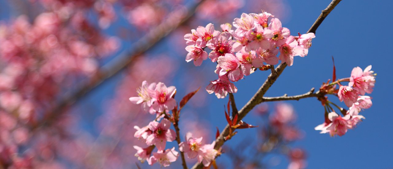
After traveling for 14 kilometers, it took us an hour to reach Phu Lom Lo. We were able to stop and rest, stretch our legs, and have some snacks. There were grilled meatballs, boiled eggs, instant noodles, and tea available. I myself was revived by some instant noodles. From the rest stop, we could see fields of wild Himalayan cherry trees in full bloom.


Phu Hin Rong Kla National Park covers three provinces: parts of Phitsanulok, Phetchabun, and Loei. Phu Lom Lo is located in Kok Sathon Subdistrict, Dan Sai District, Loei Province. As for the origin of the name Phu Lom Lo, a Mama noodle vendor told me that it comes from the cave-like shape of the mountaintop. When strong winds blow, they make a sound, hence the name Phu Lom Lo.
The vendor also told me that originally, Phu Lom Lo was a degraded forest with annual forest fires. The National Park, together with the Electricity Generating Authority of Thailand (EGAT) and PTT Public Company Limited (PTT), have joined forces to plant trees in the headwaters, including the planting of Wild Himalayan Cherry trees. Wild Himalayan Cherry trees will first bloom when they are around 7-8 years old.
With over 1,000 rai of land dedicated to the cultivation of Wild Himalayan Cherry trees, the mountain peak transforms into a breathtaking spectacle of pink when the blossoms bloom. This captivating sight has made the area a popular destination for tourists who adore the Wild Himalayan Cherry.


ลุงเสื้อเขียว
Friday, September 27, 2024 9:51 AM

