Khao Kho - Phu Thap Boek - Phu Hin Rong Kla
This is my first review of Thailand, focusing on the sea of mist fever at Phu Thap Boek during the late rainy and early winter seasons. This is when you have the best chance of seeing the beautiful sea of mist. However, my trip was in October 2015, so it may be a bit outdated. But I still think it can be useful as a reference.
On the first day...we set off in the afternoon, first on the Korat-Khao Kho route, covering a distance of 334 km, which took about 4 hours and 30 minutes.
The route will take you across the Pa Khun Pha Muang Bridge (Huai Tong), which is the bridge with the highest pier in Thailand (50 meters), located on Highway 12 that connects the lower north to the northeast. It has been in use since 1975 and is located near the junction to Nam Nao National Park.
In December 2013, a tour bus accident occurred where the bus overturned and fell off a bridge, resulting in 29 fatalities. Less than a week after the incident, we had the opportunity to pass by this spot. At that time, there were still wreckage, clothes, and belongings scattered everywhere. The bridge railing had been hit but did not seem to be badly damaged. Today, there is no trace of that day's accident left, but we still stop to commemorate the event whenever we have the chance to pass by here.

Recalling the scene of the accident at that time, coupled with the approaching twilight when hardly any cars passed by, made the atmosphere even more eerie, wouldn't you say? ><"

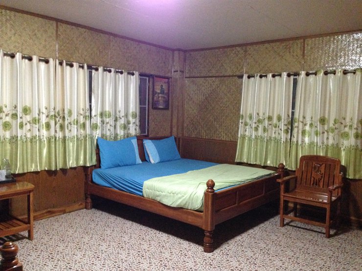
It was already evening when we arrived at Wanchaya Resort. We walked in without making a reservation beforehand. Normally, the price according to the website is 1,000 baht per night for 4-5 people. However, since my sister had stayed here before, the resort owner gave us a discount of 800 baht per room. :D

The rooms here only have fans, as the weather is cool all year round.

The room is spacious, clean, and perfectly usable.

You can buy food and eat here.

On the second morning of our trip, we started at the Kanchanapisek Chedi, just a short distance from the Waratchaya Resort. Located on Khao Kho, along Highway 2196, the chedi is an architectural blend of Sukhothai, Ayutthaya, and Rattanakosin styles.


Leaving the Phra Borommathat Chedi, we stopped by the Khao Kho viewpoint near the district office. Here, there are signs indicating the way to many other tourist attractions in Khao Kho. However, we didn't visit them on this trip because I went there frequently when I was a child. ^^"

At the Khao Kho viewpoint, there are also local villagers selling souvenirs, clothes, hats, handmade winter gear, and a small selection of vegetables and food.

Cute souvenirs at affordable prices ;)

This must be the signature dish of Khao Kho. I see it on sale at every shop ^^

Beautiful view from the viewpoint.

After driving for about 20 kilometers, we reached our next destination... Wat Phra That Pha Sorn Kaew :D
Phra That Pha Sorn Kaew Temple is located in Khao Kho District, Phetchabun Province. With its beautiful landscape, the temple is surrounded by high mountains that overlap each other, forming a series of mountain ranges that embrace the meditation hall. On the top of the high mountain, there is a cave at the peak, where many villagers have seen a crystal ball floating above the sky and disappearing into the cave on the cliff. The villagers believe that it is the arrival of the Lord Buddha's relics and consider it a sacred and auspicious place, so they call it "Pha Sorn Kaew" (meaning "the cliff that hides the crystal ball").
This is a view from the parking lot.


The construction of the Ubosot for the five Buddhas is now complete. Devotees should not enter the inner area and must walk with mindfulness and caution. As the monastic area is a zone of silence, only practitioners are allowed to use it as a secluded space for meditation.


The Phra That Pha Kaew Pagoda was built to commemorate the 60th anniversary of the reign of His Majesty King Bhumibol Adulyadej and to promote Buddhism. The pagoda is adorned with intricate patterns made of ceramic tiles and colorful stones, creating a unique and visually stunning effect. The base of the pagoda houses a collection of Buddhist teachings, parables, and a space for meditation, making it a place of spiritual significance for Buddhists.


This area is called "Tissa Kai", but I think in the north they call it something like "ลูกท้อ". It has a sweet and creamy taste, very delicious.

After visiting Wat Pha Sorn Kaew, you will need to drive out this way. It's the road that goes past the parking area.

And our destination today is Phu Thap Boek, the highest point in Phetchabun, with an altitude of approximately 1,768 meters above sea level. The name Phu Thap Boek comes from its proximity to the Hmong village of Thap Boek. ^^
With its beautiful landscape, fresh air, cabbage fields, cool air all year round, and especially this month, it is the late rainy season and early winter, when there is a chance to see a beautiful sea of fog in the morning. It is considered one of the most beautiful sea of fog viewpoints in Thailand.


It's noon now, the weather is cool and the fog is starting to roll in.


The next morning, I set my alarm for 5 am because I wanted to go up to the viewpoint to see the sea of fog. But I was disappointed because the fog was so thick that I could barely see the path. And it wasn't even clumped together, it was raining on top of that - -"
Waiting to see the sea of mist is like buying a lottery ticket. When you finally see it, it feels like winning the first prize. I've been waiting for years, and I still haven't seen it. ><
We waited for the rain to stop and hoped that we might see the sea of fog. Until it was almost noon!!! When we were sure that we would not meet... the sea of fog at Phu Thap Boek, we had to change our plans... We will go to Phu Hin Rong Kla instead.
It's noon and I still can't see the sun. I can barely see the road while driving. Be careful if you encounter this kind of weather.


Let's stop by the entrance of Phu Hin Rong Kla National Park first. This is another spot for taking photos and admiring the view of Phu Thap Boek.

Baby carrots, the small heads are so cute ^^

On a chilly day like this, let's gather around the warm stove and enjoy some snacks like corn and sweet potatoes.

Purple sweet potato :D

After buying snacks to keep us going in case we got hungry on the way, we drove into Phu Hin Rong Kla National Park. The entrance fee is 40 baht per person, plus 30 baht per car.
Phu Hin Rong Kla National Park is located on the border of three provinces: Nakhon Thai District, Phitsanulok Province; Dan Sai District, Loei Province; and Lom Sak District, Phetchabun Province.
The general topography is characterized by complex mountain ranges, including major peaks such as Phu Man Khao, Phu Phaeng Ma, Phu Khieo, Phu Lom Lo, and Phu Hin Rong Kla. Phu Man Khao is the highest peak, reaching an elevation of approximately 1,820 meters above sea level.
The first point of arrival is a historical tourist attraction related to the October people, which is the Political and Military School. In the past, it was a place for education based on the concept of communism.

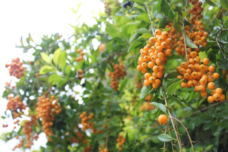
I don't know what the fruit is... I saw it falling all over the entrance of the political and military school.

This area comprises 31 buildings in total, including residences for civilians, chaplains, communications personnel, and a medical facility.


Each one is a small house with only a bed and a writing desk.


Most tourists are unaware of the historical significance of this rock at Phu Hin Rong Kla National Park. During the Communist Party of Thailand's struggle, this rock served as a refuge from carpet bombing. The injured and physically challenged would seek shelter behind this rock.


Walking out of the Military and Political Academy, looking to the right across the street, there is another spot where we will explore the water turbine.... Let's run across the street!

Just walk down 60 meters and you will see the waterfall and the water turbine.


Let's take a look at the history of the water turbine. This water turbine was designed and built by engineering students at Chulalongkorn University who fled into the jungle after the October 6, 1976 incident. This turbine provided sustenance for thousands of people on Phu Hin Rong Kla, as it used water power to drive the shaft that pounded rice, serving as the Communist Party of Thailand's rice mill.

The text you provided is already in English. Therefore, no translation is required.
After visiting the Military and Political School and the water turbine, we drove to the Hin Pum Rock Field. From the parking lot, the round-trip walking distance to explore this area is about 3 kilometers. With the cool and comfortable weather, we might have to run away from the rain a little bit :P
Before a long journey, please use the restroom. It is available for free in the parking lot area.

Let's start walking now ^^

From this point, we will walk in a circle to the right for a distance of approximately 3 km. After that, those who want to continue to the left according to the sign will also start from this point.

Let's delve into a historical interlude between 1968 and 1982. During this period, Phu Hin Rong Kla National Park, besides being a rugged mountainous forest, was also considered a red zone, permeated with the scent of death from the armed conflict between two groups: the Communist Party of Thailand and the government forces.
And this is the area where the bodies of the victims of that incident were buried.

Along the way, you will see signs with names that correspond to the characteristics of the rocks.


Beautiful nature along the way


Seeing this sign... my motivation is back :P


The Hin Pum viewpoint is located approximately 4 kilometers from the national park headquarters. It is situated on the edge of a cliff and features a field of rocks that protrude upwards in a staggered pattern. It is believed that these rock formations were created by natural erosion. In the past, the Communist Party of Thailand used this area as a convalescent camp for the sick due to its location on a cliff, which provides cool breezes and is ideal for relaxation.

The fog is so thick today that I can't see the view below, but it's still beautiful in its own way. ^^"

Continuing on to Pha Chu Thong, about 600 meters from Hin Pum, is a steep cliff with panoramic views, especially during sunset. This area was once a place where communist insurgents in Thailand would raise the red hammer and sickle flag every time they defeated government troops.

Pha Wua Kam, as its name suggests, has a Wua tree growing under this rock overhang, as if it were supporting the rock.

View along the cliff face during the walk :)


The natural rock formations look like they were carved by hand. They're really beautiful. :D

After leaving the forest, I had to find something cold to drink. Even though the weather was cool and there was no sun, I still sweated quite a bit.

On the way back, we drove along the Phitsanulok route towards Thung Salaeng Luang National Park. We saw a small group of mist floating low, and we were so excited that we had to stop the car immediately. We grabbed our cameras and jumped over the barrier to take some pictures.

The other cars were also parked for a long time. It's a good thing that the road is wide and there weren't many cars, so it didn't obstruct traffic that much. Hehe.

At first, we were hesitant about whether to stay and watch the sea of mist for another day, because we hadn't seen a beautiful one yet. But because we came in several cars with many people, in the end... we decided to go back. ^^"
Follow travel reviews and chat with the author at...
Fanpage : https://www.facebook.com/Mytravelholicdiary/
Instagram: https://www.instagram.com/my_travelholic_diary/
My Travelholic Diary
Friday, September 27, 2024 10:07 AM


