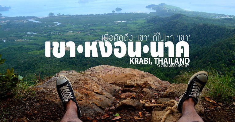
When I think of "him", I go to "him".
This trip was a one-day solo trip, with the hope of visiting "Khao Hong Nak" for the first time. Since I had bought a cheap ticket, I decided to use it. At first, I was going to book a trip to Krabi and have a fun day trip, but recently "Khao Hong Nak" has become more popular, so I took this opportunity to visit!

Krabi is a southern province that I have visited very often. I have been to almost all the tourist attractions, especially in the last 2-3 years, I feel like I haven't been away from Krabi at all. In fact, the last time I went, I intended to go to "Khao Hong" because I had never been there before. But I didn't get there because I got lost and didn't have enough time. I only managed to go to Klong Muang Beach and Nong Thale.

The route to "Khao Hong Nak" will have tourist attractions along the way, such as Nong Talay, Klong Muang Beach, Thap Khaek Beach, which can be visited all at once because it is the same route that must be passed anyway. And the last time I came, I didn't reach the end of Khao Hong Nak. This trip is like a repair. The last time I went to the city, I will go back to conquer Khao Hong Nak to fulfill my intention. Even though I booked a promotion ticket at the time of booking, I didn't know in advance where I would go. I booked it to go in the morning and evening. I traveled alone. I had only 1 day. (If you count the flight time to and from, I actually only had 8 hours.) ..I had to try it anyway!
For friends who like to travel on a budget, come say hello and follow us.
CHAILAIBACKPACKER : https://www.facebook.com/chailaibackpacker
**9:20 AM Departure!**
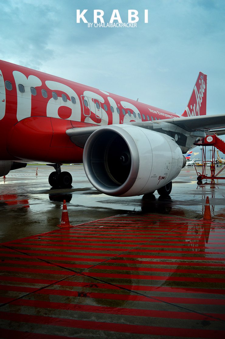
Starting my journey from Don Mueang Airport.. I was greeted by a drizzle as soon as I got off the bus and crossed the skywalk to enter the airport. Before I left, I tried to ask people in the area and watch the weather forecast, checking the weather in Krabi all the time. Because during the time before I traveled, Krabi seemed to have a storm coming in, it rained every day, and small boats couldn't leave the shore. I tried to weigh my options, should I go or not? I was afraid that if I reached my destination, it would be a waste of time. Because if I encounter bad weather, I probably won't be able to go out anywhere. But deep down, I also felt sorry for the promo ticket that I would have to throw away, even though it was a 0 baht promo, round trip for only 200 baht. When I decided to go, I tried to prepare myself. This trip is really 50/50. I guess I'll just have to see the weather conditions when I get there!

10:30 AM. Hello, Krabi!
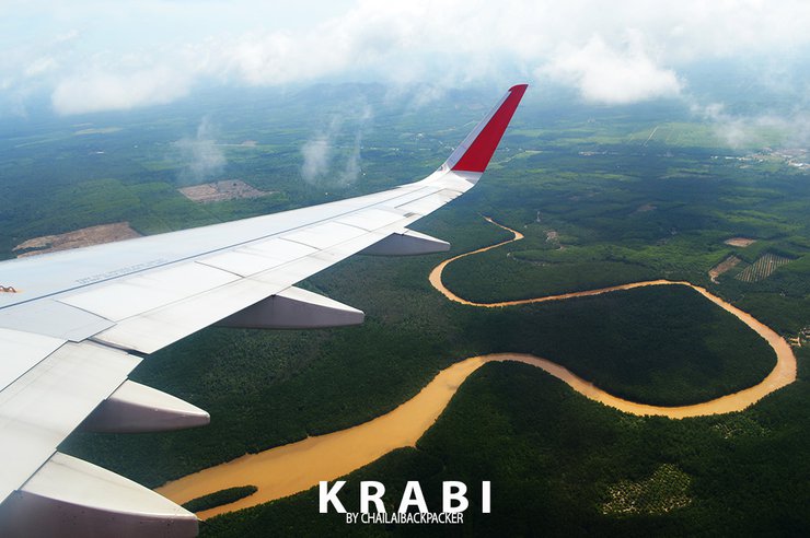
I sat glued to the airplane window, nervously watching the weather, like I couldn't help but obsess over it. I kept craning my neck to look at the clouds that drifted past, one after another. Whenever a ray of sunlight peeked through, it gave me a little hope, and I prayed that the weather at our destination wouldn't be too bad. Soon, the plane began its descent, signaling that we were almost there. I had finally made it back to Krabi.

Stepping out of the airport building, the first thing I did was look up at the sky. The sun was smiling down on me, so bright that I almost had to shield my eyes. But I didn't smile back, just smiled to myself, thinking, "The weather's good today, so I don't have to worry anymore!"
From the airport, getting into town is quite convenient as there is a Shuttle Bus service. You can buy tickets at the counter in the airport for 90 baht to Krabi town or 150 baht to Ao Nang. However, there is a more economical way to get into town, and I use it all the time. That is the public songthaew. Walk out of the airport and go to the main road in front of the airport. Cross the road to the opposite side and there will be a small pavilion. You can wait for the songthaew here. There will be songthaews passing by, just wave and hop on to get into town. It only costs 20 baht!
11.00 a.m. Lan Poo Dam - Khao Khanap Nam
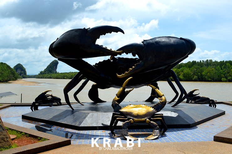
The Black Crab Monument is considered the starting point for every trip to Krabi. Whether you're coming from the airport, you'll usually end up here first, as if it's the central hub for traveling to different places. Anyone who visits Krabi must take a photo with the Black Crab Monument, which has Khao Khanap Nam as its backdrop. And today, I'm back here again, taking a songthaew and ringing the bell to get off here as usual.

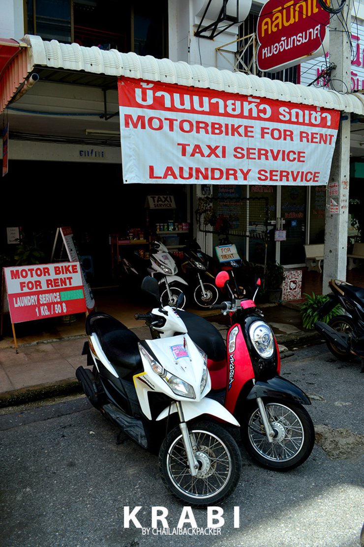
From the Black Crab Monument, walk into the alley according to the map, not far, about 300 meters, to rent a motorcycle as a means of transportation for the day.

After a short walk, we arrived at "Mr. Head Car Rental Shop", where we had rented a car on our previous trip. Returning to the same shop, the owner vaguely remembered us from our last visit. He proceeded to process our car rental, charging 250 baht per day (including 50 baht for fuel). Helmets were provided!

11.20 a.m. Krabi Town to Khao Hong
Time waits for no man.. I have to hurry to get to "Ngon Nak Hill" as soon as possible. If I have to walk up and down Ngon Nak Hill in one day, I need to have enough time and I have to be back in time for the flight back in the early evening. Therefore, I have to make time and allow for unforeseen events. Anyway, I have to hurry as soon as possible.
From Krabi Town to Khao Ngon Nak, the distance is approximately 30 kilometers. You can set your destination to either Klong Muang Beach or Tup Kaek Beach, as you will pass these beaches on your way to Khao Ngon Nak. I have set the destination to Amari Vogue Krabi Hotel, which is the last hotel before reaching the national park entrance to Khao Ngon Nak. This will make it easier to find.

Ride a motorcycle towards Ban Nong Thale on route 4034 for about 15 kilometers. You will reach Ban Nong Thale. If you look to the right, you will see Ban Nong Thale School. Behind the school is Nong Thale Lake, one of the interesting tourist attractions in Krabi. I visited it on my last trip, so I'll skip it this time. After passing Ban Nong Thale School, get ready to turn left. There is a traffic light intersection as a landmark.

When you reach the red light at Ban Nong Talay, turn left onto Road 6024. There will be a sign for Klong Muang Beach. Just keep driving. This is one of the most beautiful roads in the area. The atmosphere is humid and the sides of the road are lined with strangely shaped limestone mountains. At some points, there are mountains on both sides of the road, as if the road has cut through the middle of the mountain, separating it. Driving through it makes the journey feel more exciting and dimensional.

12.00 p.m. Khlong Muang Beach – Thap Khaek Beach
It's noon, and we've made good time! The destination we're heading to will pass by these beaches, so if we've reached this point, we're on the right track. My initial intention was to skip Klong Muang Beach and Thap Khaek Beach because I had already visited them on my previous trip. I wanted to focus solely on "Khao Hong Nak" and drive straight there without paying attention to the surroundings. However, as I glanced to the left at the beach every now and then, I couldn't help but mutter to myself, "The sea is beautiful today!" The water looked even clearer than before. I couldn't resist stopping to take some pictures and rest on the beach for a while.

Today, the atmosphere at **Klong Muang Beach** is fantastic. The sky is clear, the water is crystal clear, and there is no rain. It's quite fortunate that we didn't experience the rainy weather that was reported yesterday.
12.15 p.m. Hat Noppharat Thara-Mu Ko Phi Phi National Park
From Klong Muang Beach, continue along the beach road for a short distance. If you look around, you will see luxury hotels. Look out for the Amari Vogue Krabi Hotel, which is the last hotel before reaching the national park, the entrance to Khao Hong Peak.
Pass by Amari Vogue Hotel on the left, go up the hill for about 500 meters. This road will end at the park. The most convenient way to get here is to rent a motorbike. There are no buses passing by. If you are coming with a group of people, you can rent a car or hire a taxi, which may be expensive. If you are hoping to hitch a ride, it will be difficult because this is the end of the road.

“Hello, where can I park my car?"
The first conversation I had was after I saw a park ranger walk out of the office door to greet me and point me to park under a large tree.
"Has anyone gone up there today?"
"Do you think it will rain?"
"How long does it take to walk up and down?" etc.
Many questions I brainstormed to boost my confidence again, which wouldn't feel this way if I had a "friend" to walk with me. But today I have to walk up alone, and I think in the next 4-5 hours, I might not talk to anyone at all. There are some nervous feelings, because... I don't know what the conditions will be like when I walk in? What will the forest be like? Is there a clear path? Will I be tired? If I fall and get hurt, sprain my ankle, or have an unexpected accident, will anyone know? I just think about all sorts of things. But this kind of thing, you have to try it!
The officer's response, "There are some people going up today, they went up early in the morning," made me feel relieved. Even though there were only a few people up there, it felt good to know that there were some companions in the forest. On a normal weekday like this, **having some people around is good enough**.
Climbing Khao Hong Nak is free of charge, no entrance fee is required. However, you can donate money or put it in the Tip Box to support the place. Then, sign your name and phone number so that you can be contacted. When you come down, you must also sign out to keep track of the number of people who go up and down each day. This can be checked.
Before you start your hike, it's important to be prepared both physically and mentally. Wear comfortable clothing that allows for easy movement, such as sneakers or hiking boots. It's also crucial to bring enough supplies, including water and snacks. The park service also provides a vending machine with cold drinks at the service point.
12:30 PM Start hiking up Khao Hong Nak
As far as I know.. that the hike up and down Khao Hong Nak takes about 2 hours per leg, which is 2 hours up and 2 hours down. With enough time to hike up and down, we started walking without delay. The entrance to the hiking trail is like this!

The map at the entrance will show all the trails from the starting point to the top of Khao Ngon Nak, a distance of 3.7 kilometers. Along the way, there will be waterfalls, viewpoints, and resting points throughout the trail.

This path.. will be a nature study path in itself. Along the way, there will be signs with information, like a base or station, providing knowledge with a total of 13 stations for you to study nature up close. For me, this is also like a place to sit and rest

Stepping into the forest for the first time... The atmosphere around is shady, the nature is abundant, the air is cool and comfortable, and it is humid. On the left side, you can hear the sound of a waterfall, which is right next to the path. The sound of the water flowing is enough to make you look to the left from time to time as you walk.

Soon we arrived at the first station, aptly named "Hin" (meaning "stone"). Despite being a flat path, it was full of rocks that acted like traps. If you don't place your feet carefully, you could easily sprain your ankle. You need to be mindful when walking. The path, which had recently experienced rain, was damp and slippery, adding another layer of difficulty.

Passing through Station 2 is still considered to be on a flat level, making it not too difficult to walk. However, it is important to be careful when placing your feet. This is because the path is still full of small and large rocks, and more importantly, it is slippery from the accumulated moisture from the rain.

I've been walking for about an hour now and all I can hear is the sound of my own breathing. I'm surrounded by dense forest and nature, and I'm both excited and a little nervous about what I might encounter along the way. The scenery is truly breathtaking, and I can't wait to see what else is in store.

Head down, walking until I reached Station 4, skipping Station 3 just like that! I didn't even notice until I reached Station 4 "Waterfall". There is a waterfall on the left side for you to enjoy.

Walk a little further and you will reach Station 5 "Bamboo". There are many bamboos growing in this area. From Station 1-5, it is still considered a beginner's walk, so to speak, it's still as ordinary as kindergarten. And the number of stations that seem to be almost halfway there, the stations are not measured at equal intervals. Because the total distance walked up to this point is not even 400 meters. The journey is still long!

Walking until you reach this "Stream Crossing Bridge" signifies that you have covered approximately 400 meters, as indicated on the map at the entrance.

After passing Station 6, the trail gradually becomes steeper, making it more challenging and difficult to walk. The weight of the backpack starts to feel heavier, even though it's the same weight as before!

Turning back to look, this is one of the steepest sections of the trail, not the steepest, but it's the hardest to walk with the tree roots that grow along the wet and steep dirt path. Like this, after passing a few steep steps, I already feel tired. I don't feel like taking pictures of the scenery anymore. I start to stop and rest more often. Sweat starts to flow out like a broken water pipe. The shirt I'm wearing is soaked with sweat, as if I've been caught in the rain somewhere. When the shirt gets wet with sweat, it starts to get heavy and uncomfortable to walk in. The air that seemed shady at first now feels stifling. When I don't feel comfortable, I take off my shirt and walk now. ..It's a little easier to breathe now.

On the way up, we stopped frequently because the path became steeper. We would walk a short distance and then get tired, so we had to walk slowly, taking breaks to sit and sip water throughout the journey.

Entering Station 8 "The Vine", the atmosphere at this time will look a bit like a dense forest. The walkway looks narrower, but it's clear enough. Although there are no signs in some sections, it's still easy to walk. Just follow the path you see.

As I mentioned before... The distance between stations is not a measure of distance at each point. Some stations are far apart. I also prayed to reach station 13 as soon as possible, but I only passed station 9.

Walking along, tired and taking a break to sit down until... after a while, I arrived at Station 10. While walking, I could faintly hear people talking behind me, so I had to stop walking to listen carefully. The sound got closer and closer, following me all the way. It turned out to be a young Western couple walking behind me. I greeted them first, as I had already stopped and was resting anyway. After a few sentences, the Westerner saw that I had taken off my shirt and said, "Did you see a shirt on the way? Is it mine?" Right then... I reached for my shoulder where I had draped my sweaty shirt, and it had vanished! .. It was mine! And the feeling of having to walk back down the hill to get my shirt and then climb back up again was just the worst!

I went back to get the shirt I dropped. Fortunately, I found that... I didn't have to go back very far, about 200 meters. But 200 meters on a steep path like this is no easy feat. When I picked up the shirt, I continued on my way. Along the way, I had to climb over large logs and crawl under large branches. But the small trees along the path helped me support my body as I walked.

Throughout the journey, I haven't encountered any distance markers. I can only guess how far I've come. Each hill and steep path I climb seems to deceive my eyes into thinking I'm almost at the summit. I try to look up and around, searching for the highest point, to reassure myself that I'm almost there. After climbing another hill, I see a viewpoint... I can finally comfort myself that I'm just a little closer to the truth!


But it was like a dream that suddenly shattered in the blink of an eye when I saw this sign: 1.5 kilometers more. I still had a long way to go. In the meantime, a black foreigner walked up behind me, and I greeted him as usual. We walked side by side, chatting, and I thought I had made a friend to walk with. But after a while, he must have seen that I was walking slowly, so he asked to pass me. I was back to being alone again, quickly.

I have reached Station 11. I am getting closer to the truth. I sat down to rest and opened my small backpack, looking for a bottle of water, which was the only one left. From the beginning of the climb, all that was left were just bottles of plain water and two bottles of mineral water, which had run out during the first few stations. Now I have to manage my drinking water well. I still regret not using the water to wash my face. It would have been better to save it for drinking. After sitting and sipping water for a while, an elderly Western man walked past me. I greeted him out of courtesy. At that time, I was so tired that I didn't want to talk to anyone, not even to lift my camera to take pictures of the scenery.

We reached another viewpoint... This one really made me feel like we were getting closer to the real thing. The atmosphere was beautiful, the view was truly stunning, and I have to admit that it helped to ease the fatigue considerably. I also felt incredibly lucky with the weather today.

After resting, we continued our journey. There were still obstacles to overcome, as we often saw. At first, we could easily step over them, but later on, it was almost impossible to lift our feet.

At this point, you have traveled 2.8 kilometers. Less than 1 kilometer to go. Here, there will be a fork in the road to the right leading to the waterfall. (The staff did not recommend going there, as it seems there is little water and it is not very interesting.) Head left towards the viewpoint, which is the Naga Peak itself.

I think I've made good time and it seems like I'm getting closer to the top. Everything is starting to feel more relaxed, so I've been able to sit down and take pictures of the trees and other living things around me.


After passing a large rock... it seemed like I was almost at the end of the trail. I met a young Western couple who told me I had dropped my shirt and had passed me earlier. By now, the two of them must have been enjoying the atmosphere at the top to the fullest, so they were walking back down to the garden now. We greeted each other again, and soon after, a group of them came down. It was a group of high school students, probably on a field trip. I guess they had been walking up since morning. The group of students walking past gave me a feeling of not being alone for a while.

Resting point along the way Take a break to rest, go slowly, if you're tired, take a break......

Arriving at Station 12, only one station left. Just a little more... This time, it seems like the people who overtook me have all started to come back down. It's like I haven't even gotten anywhere yet, haha. Both the elderly-looking foreigners and the black foreigner came down quickly, followed by another black foreigner. He stopped and smiled at me, saying encouragingly, "Just a little more."

The air and the forest conditions can be felt at the current altitude and a sense of tranquility can be felt.

We have arrived at another viewpoint. The atmosphere is great, with a view that stretches as far as the eye can see. The mountains rise and fall in the distance, with the sky and the sea as a backdrop.

Take a break and sit down to enjoy the breeze. The feeling is beyond words...

The black clouds moved in quickly, instantly changing the bright atmosphere. But it seemed to pass as quickly as it came.

The luggage I was carrying didn't seem like much, but as I walked on, it felt heavier and heavier.

The weather is cloudy and unpredictable. Sometimes it looks like it's going to rain, but then the sun comes out. It's hard to know what to expect.

It feels like... walking through the middle of these 2 big rocks will finally get me to the top of the mountain... And I hope so!

3:00 PM. Naakorn Peak
Right now, I feel like I'm at the top of this mountain. Looking around, it seems like the highest point is where I'm standing. I checked my phone and it's 3 pm. It took me 2 and a half hours to get here from the starting point. It seems a bit slower than the usual walking time of the villagers. This could be because I stopped to take pictures and rest countless times.
This rock... has stairs leading up to it, allowing you to climb and sit on top to enjoy the view. However, caution is advised.

First of all, I tried walking around this area to find "people". That is, since I started walking up, I kept thinking that I would meet someone on top of this mountain, at least one or two people, or maybe some people who were staying overnight up here. But there was no sign of anyone at all, so the atmosphere around me seemed peaceful and quiet. And then I came across the last station, Station 13, right here on top!

After realizing that there was no one else around, the next thing to do was to walk and find the rock that protruded from the cliff, which I had seen on the internet. I walked around the area and found a clearing for camping overnight. There were still traces of a campfire and food preparation, which suggests that if anyone is interested in staying overnight here, they should probably stay in this small clearing and contact the officials beforehand.
Soon we came across a sign pointing to the **Naga Crest Viewpoint**, and another sign pointing to the **Naga Well**. *It is a natural spring located nearby, and its water can be used for cooking.*

Finally... I have reached the "Naga Crest", which is 500 meters above sea level. The view here is beyond words. The fatigue from the hike seems to gradually dissipate into the air. The sea breeze blows intermittently, making me feel refreshed. I sit down and rest, looking at the nature around me for a while, then open my backpack and take out some provisions to replenish my energy. Since I had breakfast in Bangkok before I left, I haven't touched any food until I got here. The provisions I brought are "dried bananas". I bought them a long time ago in Bangkok, so I brought them in my bag. I open them and eat them while looking at the view. In this kind of tired and exhausted mood, eating bananas is a good idea. It feels easy to eat. It's perfect for my body right now. At first, I was going to buy rice and put it in a box to bring up, but I thought I wouldn't be able to eat it... I really didn't feel like eating rice at that time.

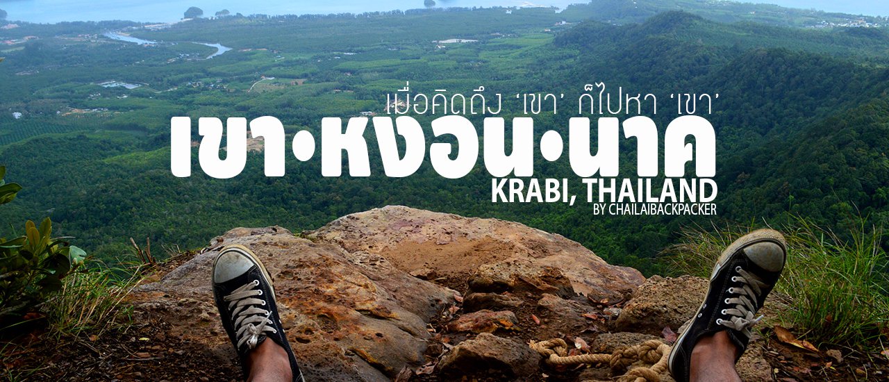
I finished the dried bananas in the box and picked up the water to drink. Oh... Now there's less than a bottle of water left (600 ml bottle). So I took two more sips of water to help the dried bananas I just ate go down and save about half a bottle of water for the walk down. Now it's time to sit and relax. I'm sitting on a rock called... Naga Crest. Sitting here doesn't seem so scary. If you notice, there's a rope tied in a knot to hold on to while taking pictures for safety.
I walked around looking for an angle to take a picture of the side of Khao Hong Nak, which is where I am standing now. It is a large rock platform with a familiar view of Khao Hong Nak. I wish there was someone here right now. I want someone to take a picture of me, I want a picture of myself sitting on that rock. But it's not a big deal, I've already conquered Khao Hong Nak once, so I'm happy.

Khao Ngorn Nak is one of the 24 stories that he tells... "In a land of dreams for travelers, surrounded by one of the most beautiful panoramic views in Thailand, who would have known that this land is the end of the love story of the Naga, causing tears to flow, forming a small pond with clear water flowing all year round. Villagers believe that when they make a wish and rub their face with the water, their wish will be granted and it will bring good luck to their lives."
1 in 24 stories that are not just told to make us believe... but to make us see!

Sitting and lying down on a large rock platform, gazing at the mountains, the water, and the sky. The panoramic view is breathtaking, immersing you in the beauty of nature. To truly appreciate the stunning atmosphere, visit during the early morning hours to witness the sunrise or the late afternoon to watch the sunset.

Lying down to rest, I gazed absentmindedly at the clouds drifting across the sky, which were moving so quickly that it was sometimes cloudy and sometimes sunny, alternating unpredictably. The sea breeze continued to blow, carrying the scent of the ocean. Everything seemed peaceful and quiet. All I could hear was the occasional chirping of small animals.
4:00 PM Farewell to Khao Hong Nak
It only took about 1 hour, which was a reasonable amount of time to descend the mountain. I stood up and walked back down for less than 10 minutes. The dark clouds that I had seen in the distance began to drizzle. So I hurried along... but I couldn't go very fast because the rain made the path muddy and difficult to walk on. I thought it would stop after a while... but I was wrong. Because it started to rain harder!
I quickly took cover under the large tree, opening my backpack to take out the plastic bag I had prepared to put three important things in: my camera, mobile phone, and dry clothes (to change into). After packing everything neatly, I headed down quickly. On the way down, I didn't take out my camera to take any pictures. I stopped and looked up at the treetops, seeing the dark clouds as a backdrop. The rain in the forest at this time made the darkness seem to creep in very quickly. Visibility was low, and I tried to keep my head down as I walked, as I had to be careful where I stepped. **...By now, the path was pretty muddy.**

Soaked from head to toe, I couldn't tell the difference between the rain and my sweat. My water supply had run out, but at least the rain provided some much-needed refreshment. Luckily, it started to pour just as I was about to head back.
Walking until I reached the "bridge over the stream", I felt happy because I was close to the exit. Arriving here, I felt a lot more relaxed. The rain also started to subside a bit... Until finally, I stood back at the starting point where I entered again. Checking the time, it took about 1 hour to walk down, which is quite fast, because I was really focused on walking. After sitting down to rest for a while, I went to sign out and dropped 100 baht in the Tip Box for the maintenance of the place. ..before I rushed back to Krabi town by car.
6:00 PM. Travel back!
I rode my motorbike back to the rental shop, soaking wet. I decided to take a shower and change my clothes there. I also arranged for a car to take me to the airport from the shop. Initially, I planned to take a shared taxi back to the airport like I did on the way there because it was cheaper. But now I think the taxis are probably gone, so I decided to book a car instead. It cost 300 baht. After showering and changing, I got in the car and headed back to Krabi Airport. Just in time for my flight!

Expense Summary
Round-trip flight ticket promotion = 200 baht
Motorcycle rental + fuel = 300 baht
Park Donation Fee = 100 Baht
Songthaew fare to the city = 20 baht
Taxi fare to Krabi Airport = 300 baht
Water and beverage costs approximately = 60 baht
This trip... cost around 1,000 baht. It was a 1 person / 1 day / 1,000 baht trip to conquer Khao Hong Nak. It was a tiring journey, but it was also fun and definitely worth the visit. If I have the chance, I'll definitely come back here again.
"Khao Hngon Nak" ... Finally, we meet again. I guess you won't miss "him" ... for a while now!
Exquisite Tourism | CHAILAIBACKPACKER
Fanpage : https://www.facebook.com/chailaibackpacker
Instagram : CHAILAIBACKPACKER
Twitter : @chailaibackpack / goo.gl/VIBXC9
CHAILAIBACKPACKER
Friday, September 27, 2024 10:09 AM

