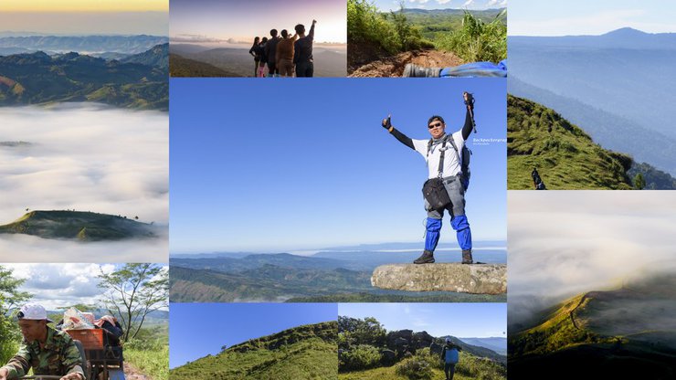

Greetings to all fathers, mothers, brothers, and sisters of README.
Trekking and Camping at Phu Bak Dai, Phu Ruea District, Loei Province: A First-Timer's Experience
This trip marks my first experience with trekking and camping at Phu Bak Dai, located in Phu Ruea District, Loei Province.
"High Risk, High Return" perfectly encapsulates this adventure, my first-ever hiking and camping expedition on a mountain. Typically, I opt for comfortable hotel or resort stays. This trip, however, demanded a departure from my comfort zone, a decision that took considerable deliberation. Reviews of Phu Bak Dai warned of "rampant leeches," "no electricity, running water, or bathrooms on the mountain," and "no porters." Yet, overcoming fear and laziness led to an unforgettable reward at the destination. Hence, "High Risk, High Return" aptly describes this journey.
How did this mountain get its name? One of the fascinating aspects of traveling to different places is learning about their history and origins. While opinions may vary, according to a local guide, the name "Phu Bak Dai" is believed to have originated during the time when Thailand was engaged in conflict with the Communist Party of Thailand. Communist forces established a base of operations on the mountain, leading to uncertainty among villagers as to whether the area was controlled by government troops or communist forces. This ambiguity is said to have contributed to the mountain's name, "Phu Bak Dai," which translates to "Mountain of Uncertainty."
It is unclear who discovered this tourist spot, but P'Jod briefly mentioned that this area used to be a barren mountain. PTT initiated a reforestation project, which led to the construction of a dirt road for exploration. This exploration led to the discovery of Phu Bak Dai and Hin Lok Luang. The community tourism initiative was started by the village headman, who still regularly visits Phu Bak Dai. One of the most memorable quotes that impressed me about the local people's mindset is, "We will plant trees while promoting tourism," said P'Jod.
While Phu Bak Dai is located in Phu Ruea District, its actual location is within the same area as the Phu Luang Wildlife Sanctuary.
Note: Some may wonder why I brought so much gear on my first trip. Let me clarify that the photography equipment comes from my hobby, the clothing and backpack are from my travels abroad, and only the tent and trekking poles were purchased specifically for this trip.
Is there anything else I can help you with?
Enough talk, let's start our journey to Phu Bak Dai.
This trip brought together a team of 10 people who rented a van from Nakhon Ratchasima province. The final destination was Tambon Pla Ba, Phu Ruea District, Loei Province, with occasional stops along the way.

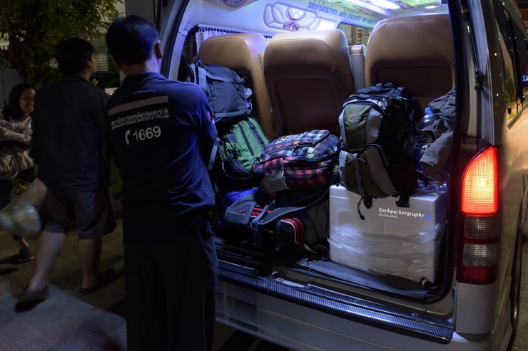
"Load your bags and supplies onto the vehicle."
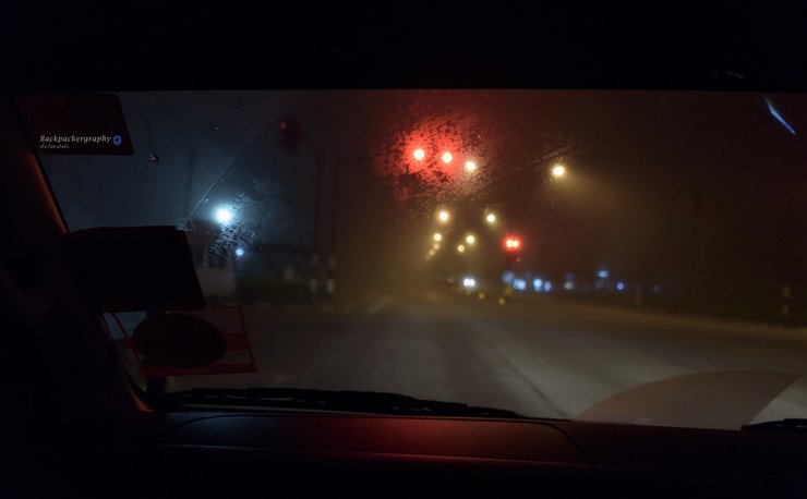
The wheels started rolling around 00:30. Luckily, I was seated in the front seat next to the driver, which gave me the opportunity to take some pictures along the way. The driver was kind enough to stop the car and wake me up to take pictures. After about 6 hours in the freezing cold van, we finally arrived at Phu Ruea District, Loei Province.

The atmosphere inside the car at around 3 am was thick with fog and extremely cold.

"As we entered the Phu Ruea district, we were left speechless by the breathtaking sea of fog that could be seen from the car."

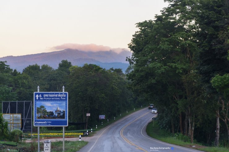
The entrance to Pla Ba Subdistrict is located opposite the road leading up to Phu Ruea.
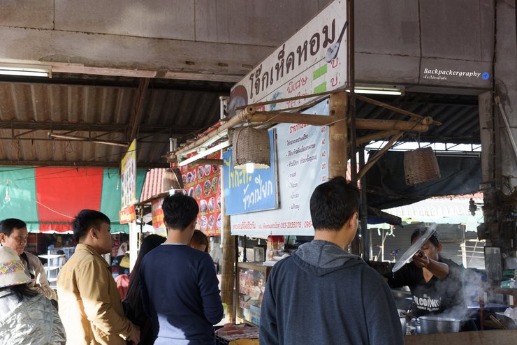
The vehicle arrived at the gas station around 6:00 AM. Everyone agreed to grab a bite to eat before continuing their journey. A team member suggested visiting the Phu Ruea Municipal Fresh Market, which is conveniently located near the entrance to Phu Ruea National Park. Additionally, there is a convenience store nearby where travelers can purchase any necessities before ascending Mount Baktride.

"This shop must be the most popular in the market. There was a long queue, so I decided to order stir-fried noodles from the shop next door instead."
Is there anything else I can help you with?

"The first meal in Phu Ruea district costs 40 baht and tastes good."
After we were full, we continued to Pla Ba Waterfall and Song Kon Waterfall, which are located on the way before reaching the Pla Ba Community Tourism Club. Pla Ba Waterfall has signs along the way, making it easy to find. It is also available on Google Maps.

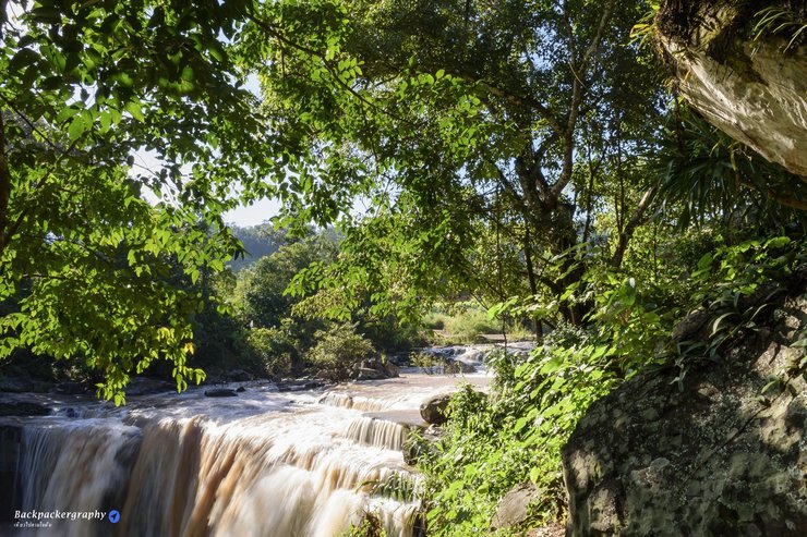
Pla Ba Waterfall boasts a powerful flow and abundant water, yet offers designated areas for safe swimming near its source.

"As I was taking pictures of the waterfall, a motorcycle casually drove through the water, leaving me momentarily stunned and almost missing the shot."

"The Songkhon Waterfall is a natural water slide. My friends and I couldn't resist sliding down it. Be careful if you visit, as I almost lost my camera while slipping."
Is there anything else I can help you with?
After getting a little wet as a ceremony, we continued to the Phu Ruea Highland Agricultural Project, which is located just beyond the entrance to the Community Tourism Promotion Club. In addition to visiting the project, you can also stay overnight there. The project has a tent camping area available for use.

"Phu Ruea Highland Agriculture Project"
"The Phu Ruea Highland Agriculture Project"
After a short walk to admire the flowers and take some photos, it was time to board the van to our final destination: Phu Bak Dai. We had arranged to meet with the local community at noon. Upon arrival at the club's office, we took a break to eat lunch, which we had prepared ourselves. We then prepared ourselves before embarking on our journey up Phu Bak Dai by "e-taek" (a type of local tractor).

"The club's office is clearly marked and located in the village headman's house. Tourists can use the bathroom and shower facilities at the headman's house before and after their hike."

"The sign at the queue for the Phu Bak Dai reservation indicates that reservations are currently available until the end of December, but are not yet full. The daily limit for tourists climbing Phu Bak Dai is 40 people, or possibly more depending on whether the club can find enough guides and e-taek vehicles."

"Prepare to ride an e-taek truck to the starting point of the hike."
The journey from the club to the starting point took approximately two hours by "e-taek" (a type of local truck). The road was rough and steep in sections, with the driver occasionally needing to stop to put chains on the wheels due to muddy conditions. At other times, passengers had to get out and break up rocks with a pickaxe as the vehicle was unable to climb over them. On steep inclines, the driver would ask one of the front passengers to get out to lighten the load. Along the way, there was a PTT-sponsored forest fire prevention and tree nursery station built for the villagers. This served as another rest stop where passengers could use the restroom and wash their faces before continuing the journey to the starting point by "e-taek".

"The terrain is rugged and steep, typical of mountainous regions."

"Riding through mud in a car, I thought it was an off-road trip."

"Though the road was rough and arduous, the scenery along the way was so beautiful that we completely forgot about the hardship."

"The path that the e-taek uses to drive up and down the mountain."

"The view from the e-taek ride was amazing."

"View from the forest fire prevention station"

"The 'e-taek' truck used to transport us up and down the mountain can accommodate two people in the front seat, with space for luggage and three more people in the back. In total, one truck can carry five people."

"The car got stuck on a large rock and couldn't climb over it. The driver had to get out and break the rock before they could continue."
After washing our faces and taking in the view at the fire prevention station, we continued our journey to the starting point of our hike. After a short drive, we arrived at the foot of the mountain we were going to climb.

"The team members who will be climbing Mount Bakaidai. I am not in the picture because I was the one who took it."

"Let's go, start trekking! This is my first time camping, and I have to admit, I was really scared of leeches. So I went all out with protection, but in the end, I still donated blood to two of them, one on each wrist. I think I got bitten when I fell, and by the time I realized it, there was blood everywhere at the campsite. After that, my fear vanished."
The driver will guide us, carry supplies, and hold our shared luggage. The initial stage involves a 200-meter climb with a 60-degree incline to the top left. The path is slippery and narrow, with sections requiring rock climbing. Leeches will eagerly greet us at this point. Upon reaching the summit, there is a clearing for a break before continuing on a flat path for approximately 3 kilometers. The total time from the climb to the flat path is approximately 1 hour to reach the campsite.

"View from the lawn above"
Is there anything else I can help you with?
Although the name suggests a flat 3-kilometer path, the reality of a forest hike is not as easy as it sounds. Throughout the 3 kilometers, the trail is quite challenging as it is a path used by villagers' cows. It is a mix of mud, alternating with grassy fields and grassy hills, with rocky slopes in between. While the grassy fields offer opportunities to stop and take photos, these breaks are short-lived due to the abundance of snails. Standing still for a few moments to take photos will result in 4-5 large snails crawling up your legs. If you need to rest, do so on the rocky slopes.

"Many people have slipped and fallen on the path above Phu Bak Dai."

"This clearing is called the Lightning Strike Clearing, named after the tree in the picture that was struck by lightning. The view is beautiful, the air is fresh, and there are many insects."

"The grassy field before the camping spot. This picture was taken on the way back because I was too tired to lift the camera after setting up the tent."
Beyond the grassy slope in the picture above, there is a camping ground and a viewpoint. After this, I didn't take any more pictures because I had to hurry to set up my tent and then walk to the viewpoint to wait for the sunset over the mountain ridge.

"Tent is set up, let's hurry and reserve a spot for photos."

"Sunset at Phu Bak Dai"

"Sunset at Phu Bak Dai"

"Taking photos during sunset"

"Taking a picture with the fake Luang rock at sunset"

"Sunset at Phu Bak Dai Viewpoint"

"The cool evening at the Phubakdai viewpoint" After taking photos, my friends and I followed the guide to have dinner. The guide set up a flysheet and made a fire for us. We had sukiyaki to warm ourselves up. Let's skip to the next morning, as we fell asleep at 7 pm after dinner and woke up at 10 pm to change into warm clothes and went back to sleep. Unfortunately, we didn't take photos of the Milky Way because we needed to save our energy for taking photos of the sea of mist in the morning.

"A description of the scene at the Phu Bak tent site in the morning, with cool air and strong winds."

"The morning has arrived, and we woke up to capture the sea of mist. We dressed up because we didn't bring any sleeping bags. The shirt was fine, but my legs were freezing. Even three layers of socks couldn't keep them warm. This photo was taken with the help of a tripod and remote control because if we set the timer and ran, we might not make it in time and could fall on the rocks and get hurt again."

"The sea of mist has arrived. This is the first time in my life that I have experienced the sea of mist."

"A scarf as a photo prop is a great idea."

"One, two, three, jump! The person filming felt a little nervous for them."

"The sea of mist on Phu Bak Dai is as beautiful as anywhere else."

"The sea of mist on Phu Bak Dai is as beautiful as anywhere else."
Is there anything else I can help you with?

"This is what they call a sea of mist, with an island in the middle."
After capturing the stunning sea of mist, my friend beckoned me to pack up the tent and join them for breakfast. However, I lingered, indulging in a few more photographs. By the time I descended, breakfast was over, leaving me with only the bread provided by the accommodation to fuel my descent.
On the way down, we passed Hin Look Luang (Pha Look Luang/Pha Hoiy Kha), a highlight of Phu Bak Dai. We stopped to capture some memorable photos, with me handing my camera to my friend for a few shots.

"The highlight of Phu Bak Dai is the deceptive rock (Pha Luak Luang/Pha Hoei Kha)."
After that, we walked down the mountain to the parking lot where the e-tag was parked. The descent took longer than the ascent, and we had to walk down and take a car down.

"They have started walking down. The person in the picture is the driver (guide)."

"Descending the trail offers a different perspective and mood compared to the ascent."

"Even when you're going downhill, you still have to walk uphill."

"Upon arriving at the e-taek parking lot, we took a moment to capture the clear blue sky as a souvenir."

"Heading back home now. They say the more you dare to get messy, the more experiences you gain. Is that true?"
We started walking from the campsite down to the e-tag parking lot from 8:00 am. We arrived at the club office around 11:30 am. Everyone took care of their personal business, showered, packed their things, and ate lunch. Then we had to say goodbye to Phu Bak Dai and our travel companions and return home.

"In closing, I would like to share a photo with my guide, driver, porter, caretaker, and teacher who taught me how to descend steep slopes."
Rough Summary of Information
- Management: The Phu Bak Dai tourist attraction is managed by the local community. Visitors must call to book and inform the community of the number of people in their group before going up. The maximum number of people allowed per day is 40, although the area can accommodate more.
- Transportation: From the community, visitors take a rugged off-road vehicle to the starting point of the hike. The journey takes about 2 hours and offers beautiful views.
- Hiking: The hike involves a steep climb of about 200 meters followed by a relatively flat trail (with some occasional steep slopes and rocky sections) for about 3 kilometers. It takes about 1 hour to reach the campsite. The flat section is not easy to walk on as it follows paths used by cows and buffaloes, and is often muddy. Many people have slipped on this section.
- Leeches: As rumored, there are many leeches on the trail. There is now sea fog in the area, and the morning air is pleasant. However, it is not recommended to camp near the viewpoint due to strong winds. The guide mentioned that even tents with bags inside can move if they are not properly secured with stakes.
- Facilities: There are no toilets, electricity, or running water on the mountain. Those who enjoy roughing it will likely appreciate this, but there are toilets and showers available at the community center before and after the hike (2 toilets and 2 shower rooms).
- Equipment: Tents, sleeping mats, and sleeping bags are available for rent, but their condition is not perfect due to wear and tear. Visitors can bring their own equipment, and the guide will help carry tents and supplies.
- Leech Protection: Leech socks are available for purchase at the community center for 25 baht per pair (they resemble pantyhose).
Coordinates of the Community Tourism Promotion Club of Pla Ba Subdistrict
Coordinates of the tent site at Phu Bak Dai (This is not yet confirmed, but I have marked it down first. If anyone has information to help confirm, it would be greatly appreciated.)
Contact information for booking a queue to climb Phu Bak Dai is shown in the image above. Phone: 087-8662648 / 095-7013139
Read other travel and tourism stories and blogs at:
facebook
Backpackergraphy Facebook page
Website
You're welcome.
Backpackergraphy
Friday, October 4, 2024 3:02 PM


