
Mae Ping National Park is a renowned tourist destination in Lamphun Province, encompassing a vast area that spans three provinces: Lamphun, Chiang Mai, and Tak. Consequently, the park boasts a plethora of attractions, including Pha Daeng Luang, Pha Khai, Kaeng Ko, Tung Kik, Ko Luang Waterfall, Ko Noi Waterfall, Tad Sato Waterfall, Tham Yang Wi, and Phra That Kaeng Sroi. Many of these sites retain their pristine natural beauty, with minimal commercial development. For those seeking tranquility, solitude, and stunning natural landscapes, Mae Ping National Park is an excellent choice and a must-visit destination in Lamphun Province.

Let's go on a trip! If you want to go, hurry up, I'll take you to Lamphun!!
**Early morning, late morning (or is it early or late? Haha) Anyway, we set off from Chiang Mai to Lamphun Province. It didn't take long before we were hungry (let's stop for a bit, wait a minute). Actually, I should mention that there aren't many communities or restaurants along the way to Mae Ping National Park, so it's best to be prepared with your own food.
11 o'clock, a good time, we arrived at the checkpoint of Mae Ping National Park (it took about 2 hours and 15 minutes from Chiang Mai to the park, a distance of 161 km). The road is paved and in good condition, no gravel to worry about. It's beautiful, like Rama, Lakshmana, and Sita. Haha.

Pay the park fee first. The price is as follows:

After completing the toll payment procedures, we contacted the staff to inform them of our arrival. However, we planned to visit other attractions before setting up camp in the evening. Since it would be inconvenient to leave the campsite after setting up our tent, we decided to explore other places first. After our conversation with the staff, we headed towards "Kaeng Ko." Let's find out what it is!
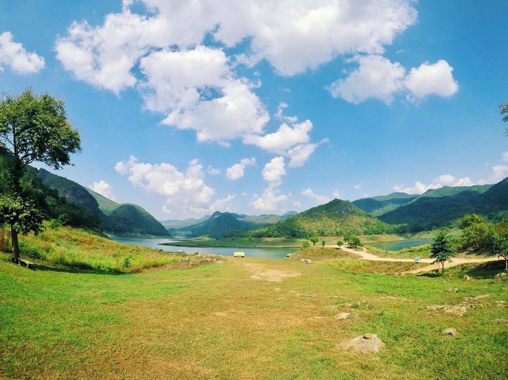
After a 10-minute drive, we arrived at "Kaeng Ko," which is a lake. It is a place to relax and unwind. You can even jump into the water! There are floating rafts to sleep on, and the scenery is beautiful, with views of the lake and mountains. It is a popular waterway between the Bhumibol Dam in Tak Province and the Doi Tao Reservoir in Chiang Mai Province. There are also many activities to enjoy, such as taking a raft to visit the floating school, the Kaeng Soir temple, and the Bhumibol Dam.
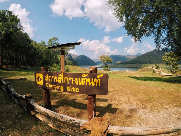
Let's get off the car first. There's a camping ground here. If you're looking for a relaxing getaway with stunning views, this is the place to be.

Walk a little further and you will reach the viewpoint.

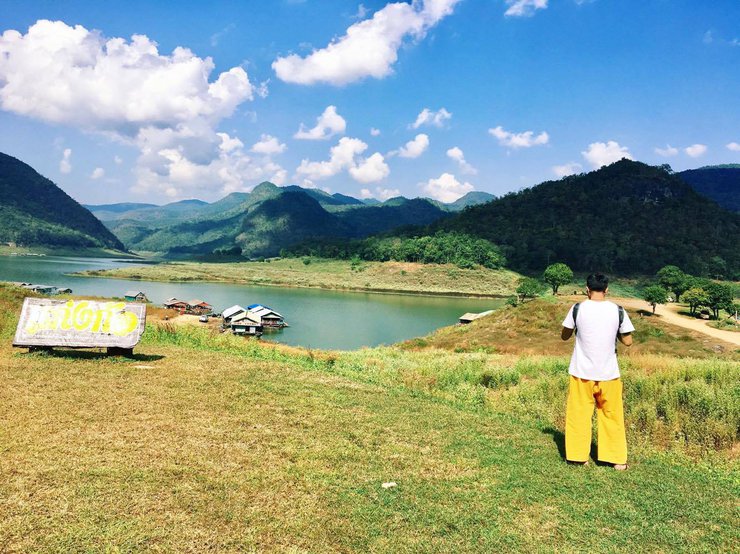
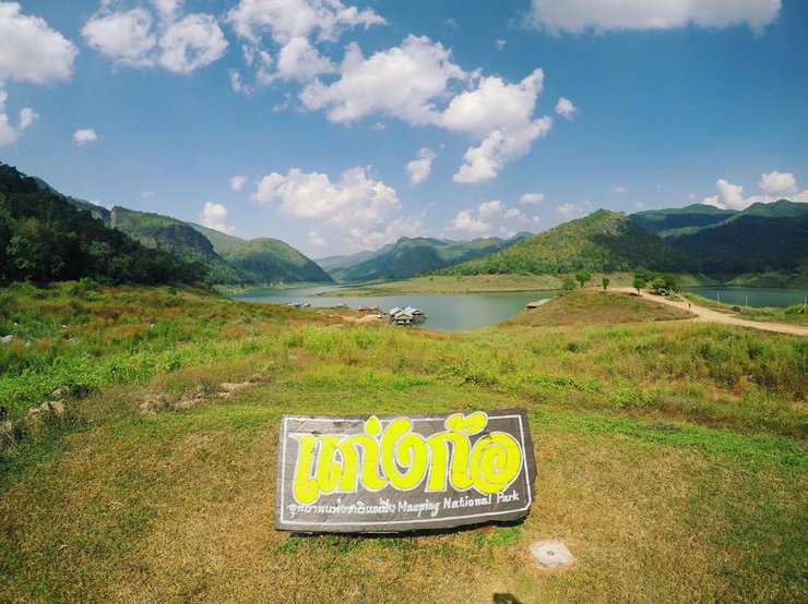
And the viewpoint sign, oh my god!! 555

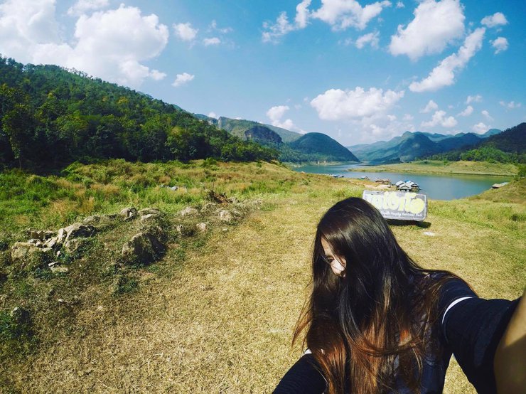
To commemorate this exciting moment, we took a selfie with the sign. Click!

Snap! I can capture others too.

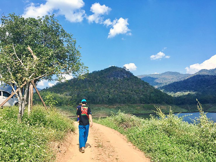
Let's go find a boat, because we're going to "The Floating School, also known as Thinking of Science." The officer told us to go to Tang Pun.

I took a wrong turn and ended up with this view instead.

Dog, please guide us.

Start by walking backwards first, my dear.

Turning left, you will be greeted by this view.

However, if you come down, it will be like this.

Finally arrived at the right place! Let's go! Vroom vroom!

Let's enjoy the scenery along the way. As for the captions between the pictures, you can skip them. 555


After a long journey, we finally arrived at the floating school. However, to our surprise, the school was deserted, with only a single dog with a drooping face remaining. We inquired (from a boatman, not the dog) and learned that the school was closed for a meeting. (We had deliberately avoided coming on Saturday or Sunday in order to meet the teachers, but in the end, we were disappointed.) Oh well, let's explore the surroundings and have some fun.


Father, do you remember when I was a child, the small cage that didn't seem too big (Be careful!)

They also practice self-sufficiency in raising chickens here (since they only raise a small number). 555

This project was inspired by (the image).


After enjoying the chicken (remember to take photos, not just eat! 55), you can continue walking around. There is a large open space, a multipurpose field for various activities.


Next is the library, a source of knowledge, photographed by someone who knows nothing about it. (Just kidding, I hurt myself. I couldn't find a stand-in in time.)

This library is still under construction due to a lack of manpower. Currently, the monks and some villagers are working hard to build it. If you would like to help, please feel free to join them.

"I'm tired. I'm going home. (Hey, hey, hey, wait a minute, brother!)"

The monk actually had another engagement outside the temple, as he had been invited to a religious ceremony. (I wonder if this is a sin? Probably not, haha.)
Let's explore the surroundings. This area is where the children pay respect to the national flag. As shown in the picture, there are only a few students. Snap!!


The dog is leaving, saying goodbye and waving. (Wait, who told you to leave? Get back here!!)

Farewell, until our next encounter.

The sun sets quickly, so let's hurry to the campsite before it gets dark. We're driving with Sofer, the bear's foot. 555


After a 10-minute drive, we arrived at Tung Kik, which we initially believed to be our campsite. However, we later discovered that the actual campsite was a 30-minute drive away on a gravel road. Unfortunately, we had no phone signal to contact the park staff. Despite this setback, we decided to set up our tents at Tung Kik, enjoying the spacious clearing.


The Teletubbies are here! It's time to have fun.

An officer passed by, and we asked them to inform another officer that we had arrived and were resting at this location. We then joked about needing to find each other again. After a pleasant conversation, it was time for the sunset. Feeling lazy to walk further, we decided to take photos right there.

For our simple and easy dinner, no need for elaborate rituals or fancy moves. Just tear open the package, heat it up, and enjoy! Yay!


Satiated and content, the scene cuts to a close-up of the lamp.
03.30 AM. The journey resumed, with our next destination being Pha Daeng Luang, a scenic viewpoint overlooking the Ping River, renowned for its breathtaking beauty. The road leading there was a mix of gravel and asphalt, flanked by lush vegetation and towering trees. The unspoiled wilderness was a sight to behold. After a 1.20-hour 4x4 ride, we arrived at the starting point for the hike to Pha Daeng Luang. Despite the lingering fatigue, we embarked on the 2-kilometer uphill trek. The trail was short but steep, taking approximately 20-30 minutes to reach the summit.

May I boil instant noodles over the campfire while I wait for him?


The long wait is finally over...


Breathtaking views that will leave you speechless. Capture the moment with your camera and experience paradise on earth.

Read more about getting to Pha Daeng Luang viewpoint.. https://pantip.com/topic/36030695
After enjoying the sunrise view at "Pha Daeng Luang", we went back down. What are we waiting for? Haha

Make a quick stop along the way.

This is the viewpoint of Kaeng Noi Rapids.

Next stop, the heart wants to dive in. What are we waiting for? Let's go to the waterfall!

Hello, I'm lost at Koh Lan Waterfall. It took me 2-3 rounds to get here. 555

Burning chest, burning heart, even if it's not hot, I have to jump in. Boom!!! Refreshing.

Given the opportunity to meet again, I will definitely have to review it again. 55

With love and rolling wheels.
See more trips... http://www.facebook.com/herdingcatsADV

จับปูใส่กระด้ง
Friday, October 4, 2024 3:13 PM