Greetings! Last week (August 19-23), we had the opportunity to visit Rinjani. We would like to share our experience through photographs to give you a glimpse of what to expect if you are planning a trip there. However, we must preface that we are merely tourists and not professional photographers. The photos may not fully capture the breathtaking beauty that we witnessed firsthand. Nevertheless, we hope that this information will be helpful for those considering a visit. Your encouragement would be greatly appreciated!
A Glimpse into Mount Rinjani
This excerpt provides a brief overview of Mount Rinjani, drawing information primarily from the Pantip forum. Readers are encouraged to offer corrections and insights to enhance the accuracy and value of this information for fellow travelers considering a visit to this majestic peak.
Mount Rinjani: A Majestic Volcano in Indonesia
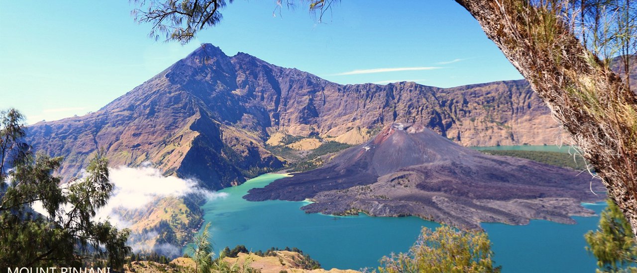
Mount Rinjani, located on the island of Lombok, Indonesia, is the second-highest volcano in the country, reaching an impressive 3,726 meters above sea level. It stands second only to Mount Kerinci on the island of Sumatra.
The Rinjani National Park, where the volcano is situated, closes the trekking route to the summit from January 1st to March 31st due to the rainy season, which makes the trails slippery and dangerous. Trekking resumes on April 1st.
At the center of the volcano's caldera lies a stunning lake known as Segara Anak, which translates to "Child of the Sea." For ease of reference, we will simply call it Lake.
The Birth of Baby Volcano: A New Peak Rises from the Depths
Following the massive eruption of 1994, a new volcanic cone emerged from the depths of the lake, aptly named "Baby Volcano" or "Barujari." This miniature peak, reaching 2,365 meters above sea level, stands nestled within the crater of the larger volcano, creating a captivating spectacle of nested volcanic formations.

Indeed, she lives up to her title as the Queen of Lombok Island.
The ascent to Rinjani Crater requires a multi-day trek, with options for both 3-day/2-night and 5-day/4-night itineraries. The longer trek offers a less strenuous experience but comes at a higher cost. Prices can be obtained from local agents. For our 3-day/2-night trek, the cost was US$250. Porters are available to carry personal belongings for an additional US$25 per day, totaling US$75 for the 3-day trek.
Note: The original text is in Thai and the translation is in English.
"Oh, I forgot to mention something very important. If you're planning to go, you should be physically fit because it will make you scream very hard. If you're not fit, you'll be in trouble.
Now, let's get serious. First, book your tickets and get yourself to Lombok. We took a connecting flight from Don Mueang to KL and then from KL to Lombok. Once you have your tickets, you can start gathering the necessary items. Here's a list of what I can think of right now:
"
1. Headlamp + spare batteries (as we will be hiking up the mountain from 2 am on the summit day).
2. Warm clothing. It's very cold up there, probably in the single digits.
Trekking Poles
The text discusses the importance of trekking poles for hiking. It mentions that if poles are not available for rent, one could try to cut a branch from a nearby tree. However, the author advises against relying on this method and recommends bringing poles beforehand.
Here's the translated text:
3. Trekking Poles: These are essential for hiking. If rental poles are unavailable, you could try cutting a branch from a nearby tree. However, this is not recommended as it is unreliable. It is best to bring your own trekking poles.**
4. Hiking boots (They're really good, I've seen many people's shoes break. I think it's dangerous.)
5. Gaiters are used to prevent volcanic gravel from entering your shoes. If you have them, great. If not, just take them off and shake them out frequently. It's up to you. If you buy them, they cost around 650 baht.
Note: Items 4 and 5 can be mixed together if you purchase ninja shoes (available at general agricultural stores).
6. Bring plenty of wet wipes, you'll need them.
7. Energy bars, candies, and sweets are great for energy on the go. It's also a good idea to bring some bread in case you get hungry. Most of the food is noodles, chicken, and vegetables like carrots, potatoes, and beans. You'll be eating these every meal, so you'll probably get tired of them.
- Raincoat, just in case the weather doesn't cooperate.
9. Sunscreen, slather it on! The sun there is very strong.^^"
10. Bring a swimsuit for the hot springs, as most Westerners wear bikinis.
11. Clothing: I think one outfit for walking and one for sleeping should be enough (personally, that's all I'm bringing haha).
I can only recall this much for now. I'll add more later. We'll start our journey on the first day, August 19th.
From Don Mueang at 8:30 am, arriving in Lombok around 7 pm.
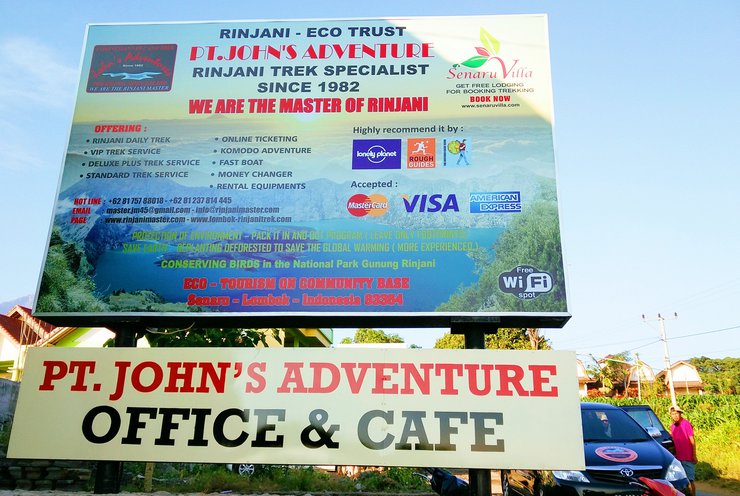
Our John Adventure will be picked up by an agent's car.

The journey from the airport to our accommodation took approximately two hours by car. The cost of transportation was included in the package.

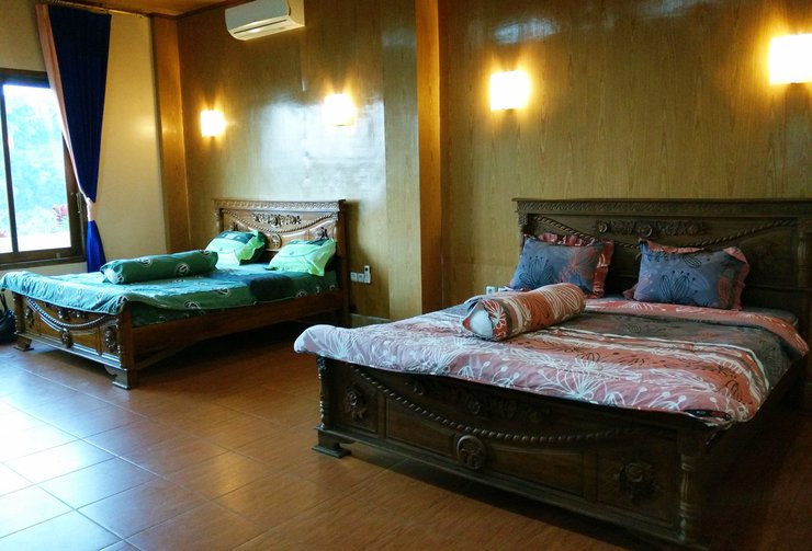
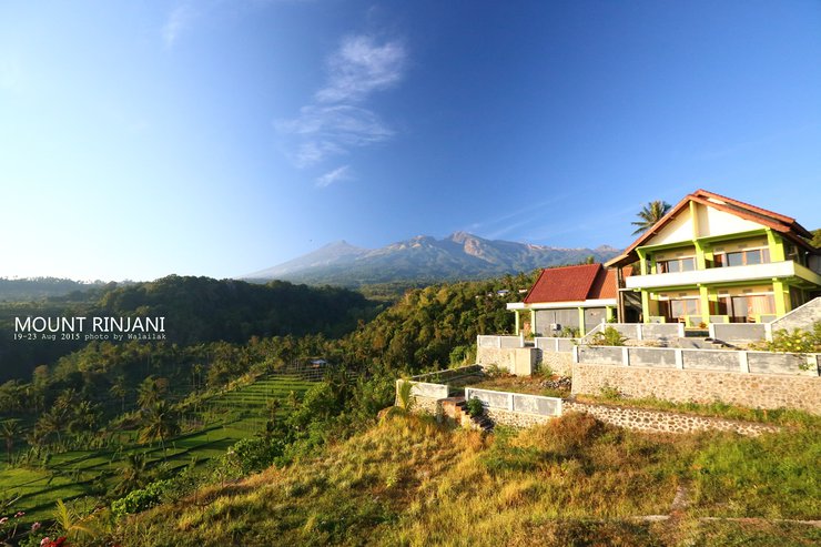
This is a picture of our accommodation, taken in the morning.
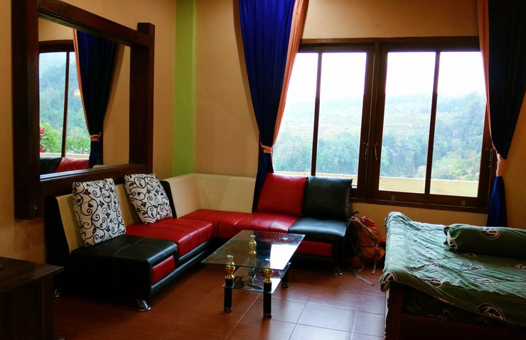
The room has 2 beds and 1 bathroom.

Mountain View style, please.

The accommodation has a restaurant. The food cost requires an additional 10% service charge. Day 1 #20 August
Breakfast before departure was pancakes, tea, and coffee.
The ascent to the summit of Mount Rinjani can be undertaken from two sides: the Senaru village side and the Sembalun village side.
Most travelers choose to ascend from the Senaru village side and descend via the Sembalun village.
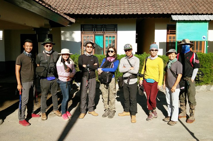
We started our ascent from Sembalun, which required a 45-minute car ride from our accommodation. At the registration point, we presented our passports and took a group photo to commemorate the thrilling experience.

Our departure time was approximately 8:45 AM. We were accompanied by two guides, one at the front and one at the back.

This is a video clip from the beginning of the walk.

The initial section of the trail traverses rolling hills and open grasslands, offering ample opportunities to capture scenic photographs and soak in the surrounding ambiance.
Arriving in pairs, looking enviable (shaking bob, pouting)


Throughout the hike, we constantly crossed paths with tourists, most of whom seemed to be ascending from the Seneru side. This provided a pleasant opportunity to exchange greetings with fellow travelers. Notably, there were significantly more Western tourists than Thai visitors on the day of our hike.
The trail is dotted with rest stops, known as Pos 1, 2, and 3, which are derived from the word "Position." Each Pos features a pavilion for休憩.

Inspired by the coolness of that group, our group wants to do the same. Hmmmmm...a difference in similarity.

The bathroom (without water) was available for us to relieve ourselves. We went in to try it out, but as soon as we opened the door, we were shocked. We rushed out as fast as we could. I thought to myself, "I'm not going to be the only one who sees this!" So I hurried to tell my friend to go in next. 5555+++ P.S. I don't recommend the bathroom. If you can hold it, do so. Otherwise, find a suitable corner in nature.
The interior of the bathroom is still etched in my memory.

We arrived at Pos 2 around 11 am. Most people stop here for lunch. The atmosphere is lively, just like Phukradung in our country. P.S. There are a lot of young Westerners here. I'm so happy as an older woman. ><

The cook is preparing food for us.

We are just sitting and lying around, waiting.

Before the main course arrives, they will serve a cereal dish that looks like this.

The food arrived. At first glance, I thought, "Where's all the chicken I saw in the pan earlier?" Then I found out that they had stir-fried it to use for the next meal.

Around 12:30 p.m., we continued our journey.
From Pos 3 onwards, the trail becomes a steep uphill climb. Looking up, I could see other tourists in the distance at the summit, which was quite discouraging.

The view from above is simply breathtaking.


The camp will also have bathrooms. Each bathroom will be a square room, as shown in the image below.

The interior is dug into a pit of considerable depth. Whoever enters first finishes their business and then fills it in, and the next person builds on top of it. At this point, you need to use your imagination a little bit. 555+
After finishing our business, we moved on to dinner, which was vegetable fried rice. It tasted like sweet and sour stir-fry and included carrots, beans, and potatoes. After dinner, we all went our separate ways to rest and recharge for the next day. For those who enjoy photographing rotating stars and the Milky Way, this location offers a clear view of the Milky Way. Don't forget to bring your tripod!
Note: It is very windy and extremely cold upwind. Please prepare your cold weather gear.
Day 2 #August 21
Waking up at 1:00 AM, we grabbed a quick sandwich to hold us over before starting our ascent to the summit at 1:30 AM. We knew we were starting earlier than the other groups, but hey, we know our limits! 😉 We also overheard that the foreigners were planning to start around 2:00 AM or 3:00 AM. ^^
The path was a narrow trail that skirted the edge of the volcanic crater. We had to use headlamps to illuminate the way, and we were tired, cold, and sleepy. From that point until dawn, we had no desire to do anything but keep our heads down and walk.
As we approached the final 700 meters, which we affectionately call the "soul-crushing 700 meters," everyone was walking like zombies, taking two steps forward and then stopping for three. Every time we took a step, we would slide back half a step. This video was taken at that point, and people were already starting to overtake us. (Apologies for any offensive language.)

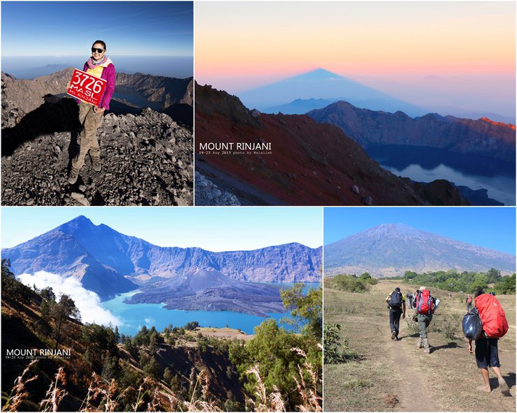
The twilight was truly breathtaking that morning, but I was too exhausted to even think about taking out my camera. After resting for a while, I managed to capture just this.

The silhouette of Mount Rinjani is a highlight, but unfortunately, I didn't make it to the summit in time to take a picture. One of my companions who arrived earlier managed to capture a beautiful shot.
It's okay, even if it's not the perfect angle, we'll just take the picture from this angle. Hehe.

Summit point
We arrived at the starting point around 7:00 AM, as we had agreed to start our descent at 7:00 AM so that we could continue our journey at 10:00 AM.
This passage describes the experience of a group of friends hiking. They are nearing the end of their journey, but the final 100 meters are proving to be the most challenging. After nearly 6 hours of hiking, they are starting to feel discouraged.
Key points:
- The group is nearing the end of their hike.
- The final 100 meters are the most challenging.
- They have been hiking for nearly 6 hours.
- They are starting to feel discouraged.
Note: The original text uses informal language and emojis, which have been omitted in the translation to maintain a formal academic style.

At this point, only three of us are left in our group. The others have all gone down.


The weather is getting hot, and the tourists who came up in the morning have started to leave. However, there are still some tourists who are walking up.

From this vantage point, we can see the path we ascended along the ridge, with people now descending in the distance. The pointed peaks in the background mark the Sembalum crater campsite where we spent the night. Looking down from here, I can't help but feel a sense of dread at the thought of the descent ahead.

Zooming in, you can see people walking down the path more clearly. This is the path we walked up last night.

If you want to see a clear picture of the trail to the summit, I recommend watching this clip. It was the clip that sparked our dream.
We started our descent at 8:00 AM, although we were supposed to start at 7:00 AM. Everyone knew that we were cheating on the time. We were scheduled to leave Sembalum Crater at 10:00 AM. Our goal for the night was to sleep at Seneru Crater, which is located at the top of the mountain on the other side of the volcanic crater. This meant that we had to descend to the camp, walk down to the lake, and then climb up the mountain again.

When it's light, you can see the path very clearly. This is the path we took last night.
Despite arriving late, we couldn't resist stopping to take photos with the volcanic crater (we just can't help ourselves! 555+++). The white smoke you see at the mouth of the crater is the Baby Vocalno, which is a smaller volcano nestled inside the larger crater. In the center of the crater, there is a lake called Segara Anak.
Note: The picture on the right intentionally includes a person walking uphill, to commemorate my own state two hours ago. 555


The telephoto zoom lens clearly captures the Sembalum crater camp from this vantage point.
Note: The original text is empty, so the translation is also empty.

We arrived back at Camp around 9:30 am as planned. Today, we had to hike down the mountain for about 5 hours to reach the Lake, visit the hot springs, and then hike up the mountain for another 3 hours to reach the Seneru crater. However, most of the members (including me) were exhausted from climbing the summit and thought we wouldn't be able to make it to Seneru Camp before dark. The guide didn't want us to night trail because the path was narrow, steep, and dangerous. So, we changed our plan and decided to stay at the Lake instead. (I was so happy because I just wanted to sleep at the same place. My legs couldn't move anymore!)
In my opinion, it would be a good idea for friends to plan a lakeside stay like this. It's less physically demanding and allows for more time to absorb the scenery along the way, without having to rush. Most importantly, the atmosphere is very similar to that of Pang Ung.
In my humble opinion, the view from Seneru Crater Camp is stunning, especially during sunrise or sunset. If you're planning a trip with friends, consider adding an extra day to your itinerary. Since you're already there, an additional day will be worth the extra hike.
This text is already in English and does not require translation.
Friends, you can watch the VDO of the Sembalum crater camp atmosphere at this link.
https://www.youtube.com/watch?v=RxJiRWm9a4g&feature=youtu.be
Okay, for those who are missing drinks, prepare a lot of money. Up here, there are both beer and soft drinks for sale. But the price is so high that it makes us lose our appetite. 5555

The minimart boasts an exceptionally pleasant atmosphere, as previously mentioned. From Sembalun Crater to the lake, the descent takes approximately five hours.
This image depicts porters or carriers descending first.


After walking for a while, we will disappear into this group of clouds.

The descent on this side of the mountain is very steep, requiring a two-hour climb down.

The next 3 hours will be a mix of uphill and downhill sections.

The terrain before reaching the lake resembles a barren grassland, similar to Khao Chang Puak. The air is filled with mist, creating a sensation akin to walking on Phu Soi Dao. It's a truly exhilarating experience.
Watch the video for the atmosphere here https://www.youtube.com/watch?v=XFOIcXAtZVI&feature=youtu.be
We arrived at the lake around 3 pm and then went to the hot spring. We walked down the hill for another 800 meters and found a hot spring like this. The guys in our group brought their swimsuits and went for a dip. They were so happy. As for us, we didn't bring any clothes, so we could only soak our feet. We were so sad. (This is the result of not doing our homework before going on a trip.) Well, at least we were able to wash ourselves here after sweating for two days.

After enjoying ourselves for a while, we walked to Lake Camp, which required us to walk to the other side of the lake near the mountain path in order to shorten the distance for the next day. Now that we've finished setting up our tents, our camp is very private. From a distance, it looks like…

We like it here. The atmosphere is really like a vacation.

The Baby Volcano is clearly visible.

The atmosphere is very similar to Pang Ung.

The area around the lake is frequented by locals who come to fish.

Clouds drifted slowly by, and the atmosphere felt truly pleasant as I sat and watched.

The moment the light hits, the more beautiful it is.

Baby Volcano in the mist

Encourage your friends to come and stay here. The air is fresh, and it's not too tiring. It's not crowded either, so the staff can easily take Time lab photos of the stars rotating.
To conclude this wonderful night, here is a picture of the Milky Way taken by my brother (I secretly took it, don't tell him!).
P.S. If you want to see more of her photography work, you can check out this thread: http://pantip.com/topic/34133970 (Shameless self-promotion here).

I'm feeling sleepy tonight, so I'll continue writing tomorrow. Day 3, August 22nd. This morning, we were woken up by a cup of instant noodles at 4 am. The vendors came to call us in front of our tents to bring us food and hot tea, as we were scheduled to leave at 5 am.

Today, we must hike up the mountain to reach the Seneru crater camp, where we initially planned to spend the night. The trek from this point will take approximately three hours.
The actual departure time was almost 7 am (so why did I wake up at 4 am???????) Before leaving, let's take a group photo as a memento.
Full attendance. Credits to the owner of the picture according to the watermark. Thank you to the handsome young sergeant (really?) for the group photo.

This morning's hike required us to follow a narrow shoulder path along the mountainside. However, at certain points along the way, we had to climb. Check out the trail conditions and our fellow hikers in this video:
The climb may be tiring, but the view of the lake behind you is worth it.

The left side of the mountain in the picture is Rinjani, and the ridge that you can see sloping down is the path we walked down for 5 hours yesterday.
On the way, we stopped to take a picture with my friend, whom I tricked into coming along. When I invited her, I only told her that the place was very beautiful, but I didn't mention that it was also challenging.
The trip ended with three of our friends losing a total of three fingers. 555

Our lovely guide's rule is that you can take photos, but you have to stop walking if you want to take them. There were many times when we put our cameras away because we were tired, but when we saw a beautiful angle, we had to take them out again.^^

The road will be like this for the next 3 hours. 10:30 am, we arrived at Seneru crater.
Panoramic photo by Sergeant (our battery died --")

This is the first camp for those who ascend from the Seneru side, also known as the Seneru crater camp. It is also a viewpoint that everyone must visit.
I wish I could have such a moment too.

The last part will be shot with a mobile phone instead. View from the Seneru side. https://www.youtube.com/watch?v=YMkUA7-gtcI
As shown in the previous video, the earlier arrivals are already seated and waiting for their meal.
Descending the final hill before the lunch break.

We arrived at that point around 11:30 am.
The last meal on the mountain.

The pineapple here is incredibly delicious, perhaps due to the exhaustion.

From this point onwards, we will no longer encounter the porters who have been carrying our food. This means that we need to tip them here, and the amount is up to us. We can pool our money together. I discreetly inquired with the guide, and he informed me that these porters earn 150,000 Indonesian Rupiah per day (approximately 400 Thai Baht). Wow, that's incredibly demanding work.
From the lunch break point, we need to walk down the mountain for another 5 hours to reach the start point of Seneru.
The initial section of the trail features an abundance of ferns, gradually transitioning into a dense rainforest.

The video was recorded before my phone battery officially died. On the way down, we passed by tourists and greeted them along the way. https://www.youtube.com/watch?v=tla9VK1GQTw
We arrived at the seneru village around 5 pm and checked into our accommodation. We spent another night at John Adrenture. Tonight, we will celebrate the end of our trip!
https://www.youtube.com/watch?v=_iCj22m5StA&feature=youtu.be
The next morning, some members of the group continued their trip to Bali (2 people) and Lombok (1 person). John Adventure provided free transportation to the port and airport for those continuing their travels.
In closing, I would like to express my sincere gratitude to everyone who has read this far. I apologize for any instances of impolite language used throughout the text.
Thank you to all the brothers, sisters, and fellow travelers who journeyed together and took care of each other until we all arrived home safely.
For those who are planning to go, please make sure you are physically fit. The summit is very challenging, but the scenery is truly breathtaking. It is definitely worth the journey. Wearing thick socks in multiple layers can be helpful.
Justsmile
Tuesday, October 8, 2024 10:28 AM

