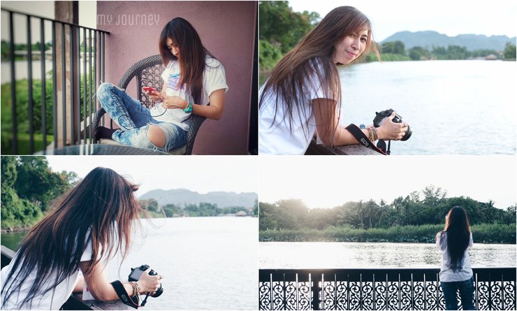
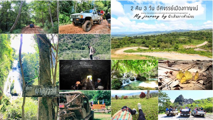
Hello, I'm Jack. Today, I'm taking my friends on a new adventure to explore the tourist attractions of Kanchanaburi Province.
After a solo rainy trip to Thong Pha Phum, the following week it was time to hit the road with my Pantip friends.
Let me tell you how this trip came about.
From July 16-18, 2016, I had the opportunity to travel with Pantip, TAT, and the lovely guides from Num Sao Tour.
We explored 5 routes in Kanchanaburi Province. I chose Route 4, which included tourist attractions in Sahakorn Nikhom Subdistrict, Thong Pha Phum District.
The campaign was called "2 Nights 3 Days Amazing Kanchanaburi".
It was all free, and I'd like to express my sincere gratitude for the excellent care we received. We all gained weight when we got back!
The tourist attractions were: Nein Sawan Viewpoint, 3D Tunnel, Mount Everest of Thong Pha Phum, Community Forest Tour, and Pha Sawan Waterfall.
I had never heard of any of these names before, so I had to go out and find answers.
I came with questions and a mission in my heart to find out what these places were and what they were like.
All I knew was that TAT and Pantip were taking us there, so the route must be amazing, especially since we had to ride in a 4WD vehicle.
Capture a clip of the entrance to Pha Sawan Waterfall and post it here. This will give your friends a sense of the fun we had on this trip.

Hold on, let me sneak in some product placement first.
Get to know each other better, want to say hello, talk, ask for advice, it's all possible, but don't ask to borrow money.
Here, the travel page captures Jack's photos. My journey by Little Traveler
https://www.facebook.com/jackrockerphotographer
In my neighborhood, we don't call it product placement, we call it selling it straight up. 5555 Let's go, let's go, let's go!
Unseen Kanchanaburi Chapter 1: Chill by the River Kwai
On the first day, there were speakers who provided knowledge about tourist attractions in Kanchanaburi, writing reviews, and taking review photos. This event was very informative.
The first day of the event will be held at the Felix River Kwai Hotel.


The first night was a blast! There was a party at midnight with a live band and souvenirs. We had a lot of fun.
But there are 2 groups staying at The Glory River Kwai Hotel, which is our group.
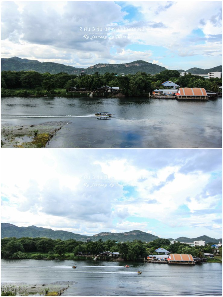
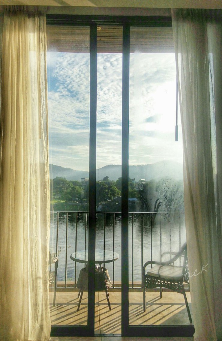
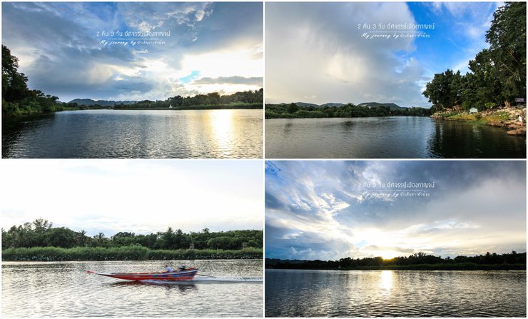
I love it very much. The view from the balcony is very beautiful. It is a view of the Mae Klong River from every room.

Everything is good.

Across the street is a restaurant. The lights are beautiful, so I'm taking a picture to share with my friends.

Good morning, new day. The back door of the room.
Unseen Kanchanaburi Chapter 2: Embark on an Adventure
The adventure has begun. Leave your body at the heavenly hill. Marvel at the 3D tunnel. Conquer the Everest of Thailand. Go and collect wild bamboo shoots from the community.
Chapter 2.1: Searching for Paradise on Earth
In the morning, the bus took us to Baan Pha Sawan Resort (our accommodation) in Sahakon Nikhom Subdistrict.
which is about 135 kilometers from Kanchanaburi city center.
Follow Highway 323 Kanchanaburi - Thong Pha Phum

Happiness happens along the way. The sky is so clear.
Just a little past the Rong Na Coffee shop, you will find the entrance on the right-hand side. There is a sign pointing the way to Baan Pha Sawan and Pha Sawan Waterfall.
We turn right and drive for about 15 kilometers. Our accommodation will be on the right, but we won't be checking in yet.
We changed the bus to a 4WD to go to the viewpoint of the heavenly slope. Wait a minute, is this real? Sitting in the back of a 4WD at around 10 am.

Challenge the sun, challenge the wind, and then look at the sky. It's cool and comfortable. 5555 We, the adventurous ones, have prepared our hearts from home.

The road is still relaxing, with some curves and inclines, but the surface is good. Cars can go through it. Enjoy the view and the sky along the way.

Soon, the driver took us to the viewpoint at Neen Suwan.


The weather is so nice today. The sun is strong, but I don't mind if I get to see a sky like this. Let the sun shine, I'm not afraid. If I can get beautiful pictures.

As part of the tour group, the Pantip team had to take a group photo of us. Yay! We've arrived at Heaven's Slope.


This is pure paradise on earth. What lies before us is a million-dollar view, with a breathtaking panorama of mountains stretching as far as the eye can see.


Clear blue sky, green forest, perfect combination, right?
Winner, the beautiful and funny guide who brings us knowledge and entertainment. Hehe.


We're having lunch here. We have a long day ahead of us, and this is the perfect place to relax and eat.

Just imagine, our rice is just ordinary, but what makes this meal special is the atmosphere.

Cool breeze, beautiful view, I want to tie a hammock and sleep.


Two motorcycles rode up, looking very suspicious. The rider of the first motorcycle took off his helmet, and I was stunned.
He is an old man with a white mustache and white hair, but he still looks strong.
The other motorcycle was ridden by a young man, who is known to have ridden from Dan Chang, Suphan Buri. He's a real daredevil.
Let's continue with the pictures.


Could you please take a picture with our amazing vehicle?


We've been told that this is also a great spot to watch the sunset, with views like this. And there's twilight too. In the winter mornings, there's a sea of fog.
Wow, my imagination is running wild. It must be so beautiful. Then I noticed the tag on my bag. It's a picture of the sea of mist at the Neinsawan viewpoint.

I want to scream, hey, this is the place! I have to go back for sure.


Watching the fog, you can also lie down and watch the stars. I don't want anything else in this life. One stop is all it takes.
With ample space to accommodate over 50 tents, it also features restrooms and showers.
There are no shops or restaurants. Please prepare your own food and tents. You can pitch your tents on the green field that we see here.
Currently, camping is allowed without any fees or prior arrangements. This information was confirmed by a park guide.
It's more like taking care of yourself, but it's safe because there are checkpoints in this area.
Jack thinks that if the tourist attractions in this area boom, there may be more systematic management.
Let's work together to preserve the environment so that the place will not deteriorate.

Please consider the following translation:
Don't forget to visit the Nern Sawan viewpoint, it's another interesting place.
Chapter 2.2: The Right Answer What is a 3D tunnel????
Let's move on to the next location, where we will find out what a 3D tunnel is like.
Descending from the Heaven's Hill viewpoint, nearby is the entrance to the 3D tunnel.

You need to unlock the key first.

As soon as I saw the entrance, I had to say "Wow!". There was nothing but forest. Can the car really get in here? The excitement was building again.

A hint of adventure in the air
We didn't have to walk long before we reached the entrance to the tunnel. I wonder what's inside?
But in reality, I got some pictures to share. I used the crappy built-in flash.
Are we really going to drive in here? Can we even get in?

As you step inside, you'll be greeted by a wave of coolness. The first thing you'll notice is

Here you go. In the past, it was a grocery store.

This is actually an old mine called the Dr. Plod Klibboua Tunnel in Kanchanaburi.
Friends may have heard the name of the old mine that is open to tourists, namely the Pilok Mine and the Somsak Mine.
Did you know that this agricultural cooperative also has an old mine that is open to tourists?
The tunnel, excavated by human labor, is an old lead mine that has existed for more than three generations. The tunnel itself is large.
Trucks can drive inside. In the past, it was used to transport minerals mined from the mountains.
Mining operations have ceased (due to the expiration of the concession).

The Sahakorn Nikhom Subdistrict Municipality believes that these old mines and tunnels are interesting.
It is suitable for organizing ecotourism and adventure activities, and also aims to promote income generation for local people from tourism.
Therefore, a request for permission to use the area from the Royal Forest Department was made, with a memorandum of understanding on the request to use the area.
To develop and open as a tourist attraction and allow local people in the community to participate in the management.
There are a total of 3 tunnels located in the vicinity, which we have entered all 3 tunnels.
The deepest tunnel, which is about 2 kilometers deep, is the first tunnel we are going to explore together.
Thank you for the information from Khun Jane, TAT.
What will we find inside? Follow me.
If you like what you've read, please vote for the post to encourage Jack. Once inside, we will see traces of mining. The path is wet, humid, and muddy. There is water flowing, but not much.


Various hopper symbols for mineral transport, stalactites and stalagmites began to form. Wow!


The water flows like a small waterfall.

Various traces

Let's continue.


The highlight was when we encountered a bat.

Bats also live here.

And then we were super excited, we managed to capture some photos, some we didn't.

Along the way, there are small tunnels dug into the mine, but they are dead ends. Some sections are used as mineral deposits, while others are wide enough to turn around a car.


And all along the way, we would encounter water dripping from the ceiling at intervals. Whoever saw it first would shout out to alert the other members.
To prepare for the escape, the main thing is to protect the camera from water. 555 There were some rocks falling, but not many. But we still have to be careful.


The grand finale was a huge set of water curtains. We were not afraid at all.

This is our delicious picture. We waited for the light from the second car and then we set up the camera to wait.


I must say that the Pantip team and TAT are very kind. They stopped to let us take pictures at important points.
Or at any point where we think, "Hey, that's a beautiful view," we can ask the driver to stop. We can do this throughout the journey before we move the car.
"Everyone got the picture?" Tim would ask, a familiar phrase that always stuck in their minds.
Okay, let's continue. You're so sweet. Thank you so much.

It didn't take long for us to find a way out, it took about 45 minutes. Here it is, when we come out we will see a tunnel sign like this.


Once we came out, we felt like visiting the tunnel was like going back in time to the era of mining.
I want my friends to come and experience it for themselves.
Visiting the mine tunnel is not permitted for tourists to drive themselves. Tourists must use the community's car and tour guide to enter the tunnel.
Due to the intricate nature of the mine tunnel paths, there is a risk of getting lost and encountering danger.
Tourists who are interested in visiting the old mine tunnel can contact us to schedule a date and time at
S.K. Nikhom Subdistrict Municipality, Tel: 034 685038
Mr. Samruam Jaisue (Mayor of Sahakon Nikhom Subdistrict Municipality) Tel. 081 995 4997,
Mr. Wari Phaphumkerik (Deputy Mayor of Sahakorn Nikhom Municipality) Tel. 084 717 5185
Chapter 2.3: Teacher, is there really Mount Everest in Thong Pha Phum?
Exiting the 3D tunnel, we looked for the mountain peak and discussed which one it was. It was the Everest of Thong Pha Phum.

Go along the way, stop by the wayside for a bit.
The guide said he saw a ripe jackfruit. He disappeared into the forest for a while and came out with a slice of jackfruit.
I couldn't eat it because it was already gnawed by animals.
Not long after we followed the path, we saw a mountain that looked like it might be it. Here it is, Mount Everest Thong Pha Phum.
Is that right? Does it look like it? I haven't shown you the picture yet 55555
The driver drove closer and closer to the mountain. Then he drove up the mountain. The people in the back were like, "Hey, are you really going to drive up there?"
The road is steep, here we go again! This trip is full of excitement and laughter. And then my brother drove us into another tunnel, this is the second tunnel already.


This one has a lot of bats, exciting, scary because the tunnel is small, the floor is uneven, and the car bounces a bit.

So we had to keep our heads down all the time. It was a short tunnel, and we were out in no time. But when we were about to leave the tunnel, the path was steep and we had to slide down a little.
We're about halfway up.


And then we walked up, but not to the top, haha. Conquering Everest at one in the afternoon, in the blazing sun? No wayyyyyyyyyyy.
Someone has already conquered it. There is a flag planted on top.


Exploring the area and looking for photo spots.


The member has already taken it.


Everyone is really cool.

Today, we only conquered half of the mountain. It's time to get on the bus.

Nong Do took this picture for me. It's beautiful, I love it.

I immediately thought of a caption when I saw myself on the mountain.

I love this so much 5555


We walked in the hot sun, waiting for the rest of the group to get on the bus. We stopped to cool off in the cave and looked at the animal footprints first. The tunnel was very cool.
Now that it's not hot anymore, let's continue. Go down to find a corner to capture the overall picture below. On this way down, we enter the tunnel again.
Then we went into the big tunnel (completed 3 tunnels) to take pictures of the mountain from a wide angle.
Let's see if it's like Everest or not.


It doesn't look much like Everest, but is it enjoyable? Yes, it is.

And do you want to know why it's called this? You have to read this information.

Mount Everest is one of the mountains in this area, and it is the mountain with the most minerals.
The Karen people call it Airplane Mountain because the mine used to land airplanes there.
This mountain has been drilled into many tunnels. Climbing up and pulling the rope looks very difficult.
And it's very difficult, like climbing Mount Everest in the Himalayas, Nepal.
This is why this mountain is called "Mount Everest".
Okay, I understand. I understand now.
Everrest Thong Pha Phum is still waiting for everyone to conquer. But don't come at noon, or you'll melt. 5555
Chapter 2.4: How important is the Sahakon Nikhom Community Forest to the villagers?
Information please.
The community forest is located at Ban Pa Mai Saphan Lao, Sahakon Nikhom Subdistrict, Thong Pha Phum District, Kanchanaburi Province.
Permission was granted by the Royal Forest Department on February 17, 2014, located in the Huai Din So community watershed area.
The area boasts a permanent water retention system and is home to a rich abundance of natural resources, including the 400-million-year-old "Hia Thod Plong" grass and the colorful "Poo Roi See" crab.
Giant cicadas, large banyan trees, palm groves, wild cannas, and a variety of wildlife


Here is the entrance. When we enter, we have to ask ourselves again, can we really enter? It's another forest.


Some sections of the road are flooded.
Throughout the journey, we encountered obstacles such as trees and branches. We had to constantly communicate with our fellow members to avoid them.

As we ventured deeper, the obstacles grew more numerous, with large branches blocking our path.


Our guide had to constantly cut and clear the path for us, so we moved slowly.

Along the way, we will encounter a variety of trees.
Which has a well-placed name tag. The highlight of the day is


Nhor bong is a large bamboo shoot that is ready to be harvested and used in cooking.

They got a lot. Here, villagers can come and collect these products.
After collecting the bamboo shoots, they had to continue to fight their way through the forest.


To the very end

We have to go now. This is the water deceleration area. There are small groups of butterflies to give us a little excitement.


Wondering where the water went and how it got there, as I couldn't remember the details, I opened Google Maps and traced it to see.
Where does the Dinso Canal flow? This canal flows into the Mae Klong Noi River.
The Khwae Noi River then converges with the Khwae Yai River, forming the Mae Klong River.


As you walk inside, you will be greeted by a large banyan tree and a variety of other trees.
This area has tables and benches for visitors to sit and rest. You can bring food and eat here.


Community forests are likely to be a source of water and abundant food for villagers.


After that, we left the forest and went to our accommodation. I'm exhausted today.
This is the information about the community forest. I apologize that Jack didn't get much detail because he was too busy taking pictures and didn't listen to the guide very much. 5555
Entering this natural area requires prior permission from the community forest committee. It is feared that once you enter, you may get lost.
Therefore, there must be a leader to guide us to be safe from danger.
Summary
The tour route in Chapter 2 is a continuous route.
Chapter 2.1 You can travel on your own without having to contact anyone.
However, for Chapters 2.2-2.4, you need someone to take you there. You can contact your accommodation. Most accommodations in this area offer tour guide services. For example, during our visit, our guide told us that he had contacted a car from Baan Pasawan Resort to take us on a tour.
Or if you want to go by yourself, without staying anywhere, let me emphasize again that you should not go in alone. It could be dangerous.
Tourists who are interested in visiting the old mine tunnel can contact us to schedule a date and time at
Sahkon Nikhom Subdistrict Municipality, Phone: 034 685038,
Mr. Samruan Jaisue (Mayor of Sahakon Nikhom Subdistrict Municipality) Tel. 081 995 4997,
Ms. Wari Phaphumkerik (Deputy Mayor of Sahakon Nikhom Subdistrict Municipality) Tel. 084 717 5185
This route is a great option for a day trip, and you can even camp at the scenic viewpoint for a night.
Jack's clumsy review skills made his friends want to try new experiences.
As a tourist, please help us preserve and protect the beauty of this place so that it can stay with us for a long time.
Memories are all that remain, captured in photographs.
----------------------------------------------------------------------------------------------------------------------------------------------------
Unseen Kanchanaburi Chapter 3: Sai Yo's request to tell the story of Pha Sawan Waterfall We found that the source of the fun is the extremely difficult path. How will we get through it!!!!!!
On the morning of the 3rd, the plan is to check out of Phasawan Resort and then go to Phasawan Waterfall. Come back to get on the bus at the resort.
Have lunch at Rong Na Coffee shop and pick up group 5, 4WD car from Pilok Mine. Then return to Bangkok together.
Okay, then we have to keep time. So the 5 o'clock flight won't have to wait for us long.
Have breakfast and then head to Pha Sawan Waterfall. Let's go!!!!!!
From the entrance of Baan Pha Sawan, if you look to the right, you will see the entrance to Pha Sawan Waterfall. Follow the path, and you will find fruit orchards belonging to the villagers along the way.
The road gradually becomes more challenging, with sections of steep inclines. The surrounding landscape is dominated by bamboo forests.
The bamboo branches would bend and obstruct the path at intervals. Whoever saw it first had to tell the other members and warn them to avoid it.
"Keng mai ka, lop ka, yo ka, kan rao laeo riak kan wa sai yo."

Other people's cars won't have seats, they'll be sitting on the floor of the pickup truck, so they won't have much of a problem with the bamboo branches.
But I was sitting in the back of the car, while we were sitting in the front. I had to turn my head to the back. Sometimes, after listening to P'James, I turned back and there were bamboo branches and leaves all over me. 555 I couldn't let my guard down.

The road is a gravel road, and it gets muddy during the rainy season.
There is a small wooden bridge here. You need to get out of the car and let the empty car cross the bridge. The bridge cannot support a lot of weight.


Cross the bridge and continue.


We will see the sign again. Tell the way to Pha Sawan Waterfall 4 km. Wowwwwwwwwwwwwwww so close.

But look before you go, okay?

You see the way, right? This is the problem.

Two cars passed by. The third car honked its horn, signaling that the car was stuck in a pothole.
Let's cut to the member whose car got stuck in the mud. The license plate fell off.


Jack said he wants to have a shared experience. He asked to take a picture with me. 5555

Our car took on the task of towing. The first round was unsuccessful.

Round two is up, yay!
It was an amazing experience for us. 55555555 We had a lot of fun even when we faced some obstacles.

A short walk later, we arrived at the waterfall.

Upon reaching the waterfall, we encountered a group of adventurous tourists. They were camping in groups, and there were dirt bikes that were just leaving.

There are actually tourists here too. In the future, if the road is good, this area will probably be full of tents. I wonder what the impact will be on nature.
Let's get to know Pha Sawan Waterfall first.
Information from sahakornnikom.go.th
Phasawan Waterfall is one of the largest and most beautiful waterfalls in Thailand. It is located deep in the forest amidst lush nature.
Surrounded by dense trees, in addition to the magnificent beauty of the waterfall that attracts people to explore.
Many people want to test their endurance by trekking through the forest and wading through mud, making it an ideal destination for adventurous travelers who love exploring waterfalls.
Adventure and hiking enthusiasts will appreciate the off-road trails leading to the waterfall.
The driver must be experienced in off-road and mountain driving, as the route is quite challenging and rugged.
Under the care of the Srinakarin National Park, Thong Pha Phum District
On the west side, the water flows as Pha Sawan Waterfall and continues as Pha Tad Waterfall. Pha Sawan Waterfall is surrounded by a lush forest.
It takes about 40 minutes to walk from the bottom to the top of the waterfall.
Tharn Sawan, Hin Krinari Pool, Tham Kaew Pool, Pha Khon Tham, Pha Thepbutra, Pha Pherun, and Pha Sawan
This area does not have many facilities. There are only houses for officials. The area of the Pha Sawan Waterfall Forest Protection Unit
Nestled amidst a pristine natural forest, the campsite boasts a crystal-clear stream meandering through its lush greenery. While offering ample space for tent pitching, it lacks any commercial establishments.
Or the restaurant provides an open-air kitchen for staff to cook.
Tourists must bring their own food and water.
From the campsite, it takes about 1 kilometer to reach the first level of Pha Sawan Waterfall.
Jack also learned that there is a path from Pha Tad Waterfall to Pha Sawan, but you need to contact the officials.

Let's start walking now.
The Pha Sawan Waterfall Trail is a semi-deciduous forest with an open canopy, mostly bamboo forest. From the flat ground, the trail gradually climbs upwards.
Some sections are wooden stairs, some are rocks, and some are mud. The path is very slippery, so extra caution is needed. Appropriate footwear should be worn.


Let me preface this by saying that Jack might have taken some really bad photos in this set. There were no filters, so the lighting is a bit overexposed. Some of them were even taken freehand.
Using a tripod sometimes, the ground was sometimes stable and sometimes not. Let's just say I shot as best I could, from floors 1-6, hurrying to get to the next one.
Soon we found the 1st floor, Tharnsawan.


The waterfalls in the upper tiers cascade down into shallow pools.
Floor 2: Nang Hin Kinnaree Basin


Actually, Jack should stand in the water corner, it would be more beautiful, but he's wearing sneakers, so that's all I can get.

Let's hurry up and take the photo, then we can walk on. Let's go!
The walkway, please.

3rd floor, Ang Tham Kaew

The light is too bright 555


4th floor, Pha Kan Tham


The higher you go, the steeper the path becomes.

From the 5th level of Pha Thep Waterfall, the water will be stronger because it falls from a steeper cliff.
But we didn't find any water in this layer. But look, if there was water, it would be beautiful.

And then we hesitated whether we should go up or not. Of course we have to go up! We are adventurers!
Although my legs were starting to feel weak, since we had already come this far, we had to keep going.
Reaching the 6th floor, Pha Pherun is a large cliff as well. There is only this much water.


The top floor is the 7th floor, Pha Sawan, which is the highest cliff.
The path is a short staircase on the top floor. Walk up and look up at the waterfall in front of you. Scream, there is water!

And the image in front of you is a waterfall cascading down a towering cliff, forming a breathtakingly beautiful and majestic cascade.


A lot of pictures were taken.


The Pha Sawan Waterfall was very tiring. Was it worth it? Absolutely! I'd love to go back when the water is high.
But it's probably difficult, the path is too difficult.

We are really late. It's past time. Come down and wait for all members to be present so we can prepare to go back.


I just noticed that there are many groups on the way back from the car.
We returned to the bridge where we had to get off the car. There was a team that came to explore, running off-road. We set up the camera and waited again.


Beautiful
We went back to change and get on the bus at Baan Phasawan, and then we had lunch at Rona Cafe, exactly as planned.
However, we were very slow. The group of 5 who came to wait for the bus with us arrived a long time ago and have already finished their lunch. 5555
The trip was amazing, exciting, and hilarious. Thank you to Pantip and TAT for taking us on this new adventure.
Thank you to my fellow travelers who share the same passion and love for travel as I do.
The specialness of this trip happens all along the way, if we look at it as fun.
"Happiness begins the moment you set out on your journey."
I hope this review will be helpful to my friends, even if it's just a little.
My journey by Little Traveler
https://www.facebook.com/jackrockerphotographer
นักเดินทางตัวน้อย
Friday, September 27, 2024 10:19 AM


