


I have fallen for "him".

A land of mountains, surrounded by peaks, where the night sky twinkles with countless stars.
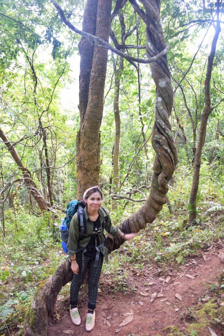
A new friendship with a stranger begins, along with this journey.

Doi Phu Wae is located within Doi Phu Kha National Park, in Khun Nan Subdistrict, Chalermprakiet District, Nan Province. The peak of the mountain is 1,837 meters above sea level. It requires an 8-kilometer hike to reach the summit.
There are two routes to the top of Doi Phu Wae:
- The Ban Dan route, which is steep but closer. We chose to hike up the Ban Dan route.
- The Pang Kwai route, which is less steep but longer.
**We traveled by van from Bangkok to the National Park, which was convenient in terms of transportation. This is because there are no public buses that go directly to the park. Therefore, it is necessary to rent a car, hire a car, or hitchhike, which can be difficult as there is very little traffic on that route.**
**What to prepare**
- Tents (not available for rent in the park)
- Sleeping bag (The park does not offer rentals)
- Food (you have to cook your own food)
- Water (prepare enough, there is no water source above)
There are two water refill points along the trail. The first is located near the village, and the second is near the cornfield. The staff will inform you of the exact locations.
- Wet wipes for dry water seats
- Flashlight
- Winter clothes, gloves, socks, and hats are recommended due to the cold weather at the summit.
- Picnic stove for cooking or making fire on top, but the wind is quite strong.
- To hire a porter, please contact Doi Phu Kha National Park before your trip. Porters charge 1200 baht per person and can carry approximately 20 kilograms of luggage.
- To conquer Doi Phu Kha, you must contact Doi Phu Kha National Park in advance at 082 194 1349. The park limits the number of tourists to 90 per night due to limited camping space.
- There is a fee of 800 baht per guide for a guide.
We set off on the night of the 3rd of the last month of the year 59 by van from Bangkok.
DAY 1 December 4, 2016
We arrived in Nan province around four in the morning. We stopped to buy things at a fresh market along the way. The morning air here was cool and almost cold, with a faint mist floating in the air, making us feel refreshed.
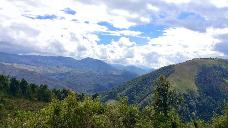
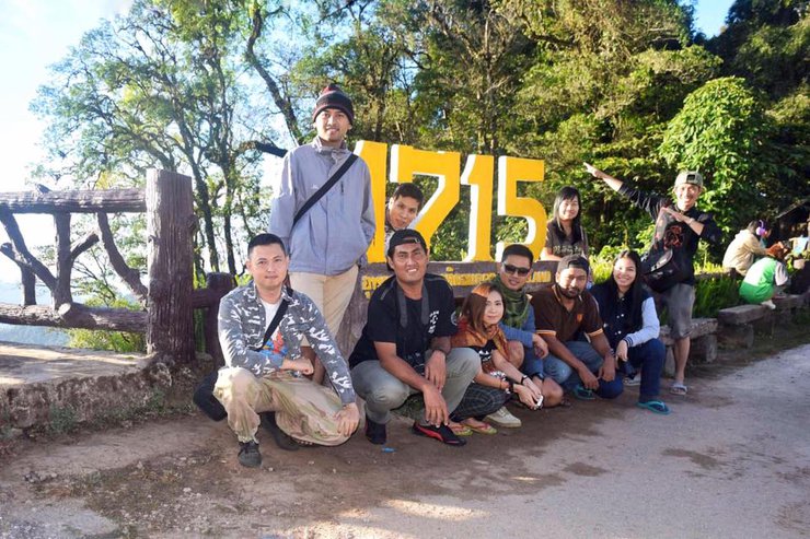
Vans drove steadily along the winding road, offering glimpses of mountains both large and small. Some were bare, with young trees beginning to sprout, while others were being used for pineapple, corn, and rice cultivation. Finally, the vehicle stopped at the "1715 Viewpoint" in Doi Phu Kha National Park, where the morning sunlight was truly radiant.

After taking some beautiful photos, we continued our journey to Ban Dan.

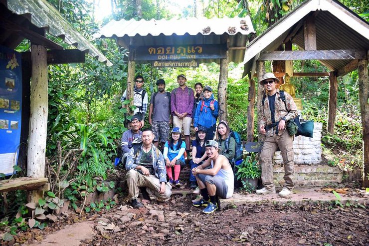
We opted to hike up to Ban Dan, where a guide was waiting for us (we had contacted them in advance).

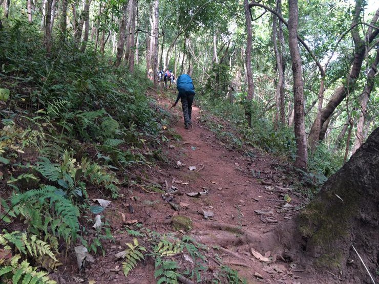
The trail begins with a steep incline that gradually increases in difficulty. Despite the challenging ascent, the dense foliage overhead provides ample shade, mitigating the intensity of the sun's rays.


Emerging from the forest, the path becomes a steep, red dirt road leading up to the village. Unlike the shaded trail through the woods, the sun beats down mercilessly, making the air hot and humid. Sweat pours down our faces as we trudge uphill, but the panoramic views of the surrounding mountains and lush greenery offer a welcome distraction.


And so we arrived at the village.
The sentence suggests that we are halfway through our journey (probably). The people in this village are friendly. Children stand in front of their houses and greet us with a cheerful "Hello" and a smile.
This small village, with a population of less than a hundred, is characterized by its simple bamboo houses. The houses are constructed by splitting bamboo into strips and weaving them together to form the walls and roof. The floors are raised slightly off the ground, creating a space beneath the house where sacks of corn are often stored. Some houses have wooden platforms for sitting, while others keep pigs in the space below. Black pigs are a common sight in the village, with almost every household raising them. A small building serves as a school for young children. The majority of villagers earn their living by cultivating corn, with some also engaging in rice farming.
There is a water tank in the village where we can refill our water. However, it will take a while before we find another water refill point. . .


A short sentence written on a sign: "We love our King." His Majesty the King remains in our hearts always and everywhere. . .

Upon exiting the village, we encountered the villagers' cornfields, where we were forced to endure the scorching sun with no shade. The absence of large trees indicated that the area we were traversing was once a mountain, now reduced to a barren peak.


The landscape unfolds, revealing stretches of open land that were once rice paddies or cornfields, now harvested. The distant vistas on either side of the road compel us to pause and capture the scenery. Rolling hills extend as far as the eye can see, some devoid of trees. We can only hope that they will not succumb to further deforestation.


As the sun beat down relentlessly, sapping my energy, I knew it was time to replenish my strength with a midday meal. Opting for a simple and satisfying option, I chose the classic combination of sticky rice and grilled pork.

The journey continues with renewed energy. We follow the shoulder of the hill, which is both a cornfield and a rice paddy, until we reach the wooden fence that separates the cornfield from the forest. . .

The initial forest trail alternates between flat and steep sections. As you continue, the path becomes predominantly steeper, leading to the campsite on the mountaintop. This vantage point offers breathtaking 360-degree views. After traversing the challenging uphill sections, you'll finally reach the designated camping area.
**Camping area:** This area is a small, flat meadow with no large trees. There is no water source at the campsite, so be sure to bring enough water with you. Importantly, there are no restrooms, only natural facilities. We set up our tents and prepared dinner, then walked to the top of Phu Wae Mountain to watch the **sunset.**
From the campsite, it takes an additional 20-30 minutes to reach the summit of Doi Phu Wae for panoramic views.

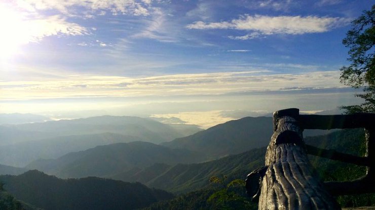
From the mountaintop, one can see numerous peaks forming a long, continuous ridge. There are rocky plains and cliffs. This is considered a **scenic viewpoint for both landscapes and sea of mist** (although we didn't encounter the sea of mist, we saw a sky full of stars instead).


The sun began to set below the horizon, and the clouds gradually moved to cover the peaks of each mountain until they were out of sight, and finally, it became dark.


. . Our evening meal . .

The air at night is very cold with occasional gusts of wind. Dew falls in the late hours, and the stars are so numerous and beautiful that they fill the entire sky, seemingly within arm's reach (no pictures were taken as I did not bring a camera; the image is from a mobile phone). In addition to the stars in the sky, the Milky Way is also clearly visible. The later it gets, the colder it becomes, and the stars shine brighter, competing with each other across the vast expanse of the sky.
As the new day dawned, we awoke despite the cool air, eager to prepare ourselves for the ascent to the summit of Phu Wae Mountain to catch the first rays of the morning sun illuminating the mountain ridge.
The golden light began to shine in a long path, the sunlight of a new morning. . .

Empower me. . .

The golden rays of sunlight pierce through the clouds, illuminating the mountains. It heralds the dawn and marks a special day: **"December 5th, Father's Day."** The beloved King will forever remain in our hearts.

The Highlights of This Place
The rolling green meadows along the mountain ridges, bathed in sunlight, gradually turn golden as the sun sets.

We have conquered Doi Phu Wae.


Finally..
Thank you for the good friendship from the trip to Doi Phu Wae. See you again on the next trip. .^^

dandelion
Wednesday, February 26, 2025 4:53 PM