
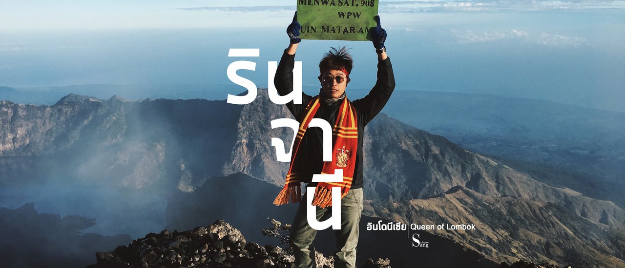


... Rinjani ...
Every journey
Build friendships
"And experience"
#Moonlight
"Mount Rinjani" The first time we heard the name, we were confused about where it was and what it looked like. We might have felt indifferent, but when we saw the picture, it made our hearts beat faster again. We wanted to experience it, to test our physical and mental strength. Rinjani is the second highest volcano in Indonesia, with an altitude of 3,726 meters above sea level (Doi Inthanon 2500 meters). In the past, Mount Rinjani erupted violently, causing part of the crater to collapse, forming a basin that became the Segara Anak Lake. However, some parts are still erupting, forming a small volcano in the middle of the lake called Barujari.
-----------------------------------------------------
Travel
Outbound: Donmuang >> Kuala Lumpur (Malaysia) >> Lombok (Indonesia)
Return flight Lombok >> Denpasar (Bali) >> Donmuang
-----------------------------------------------------
Trekking routes
Day 1: Senaru Village - Sembalun Village (1,150 m) - Sembalun Crater Rim (2,639 m)
Day 2: Hike from Sembalun Crater Rim (2,639 m) to the summit of Mount Rinjani (3,726 m), then descend to Segara Anak Lake and Hot Springs (2,008 m).
Day 3: Segara Anak and Hot Springs (2008 m) – Senaru Crater Rim (2,641 m) – Senaru Village (601 m)
Day 1: Senaru Village – Sembalun Village (1,150 m) - Sembalun Crater Rim (2,639 m)
My journey began in Saraburi at around midnight on August 9, 2017. I started my trip by taking a bus to connect to a flight, then another flight to Lombok Island, and finally a car to my accommodation. The total travel time was almost 12 hours, arriving at my accommodation around midnight. I had to wake up early the next day, so I went to bed early to prepare for the mountain climb the following day.
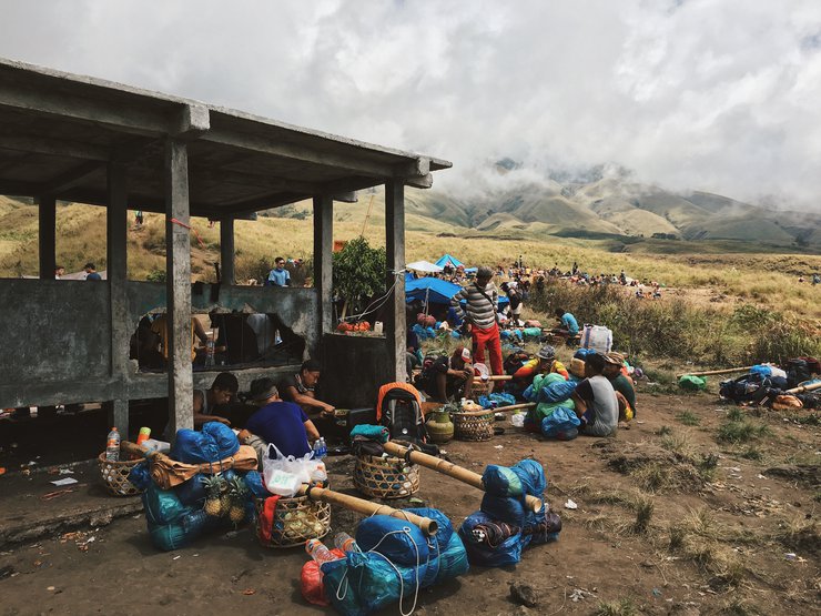
In the early hours of August 10th, we embarked on a 45-minute journey from our accommodation to Sembalun village (1,150 m), the registration point and starting location for our trek.
At 8:00 AM, we began our trek with the initial goal of reaching the Sembalun Crater Rim (2,639 m), which also serves as a campsite. However, our first actual stop was Pos I (Pemantauan, 1,300 m), the first resting point.
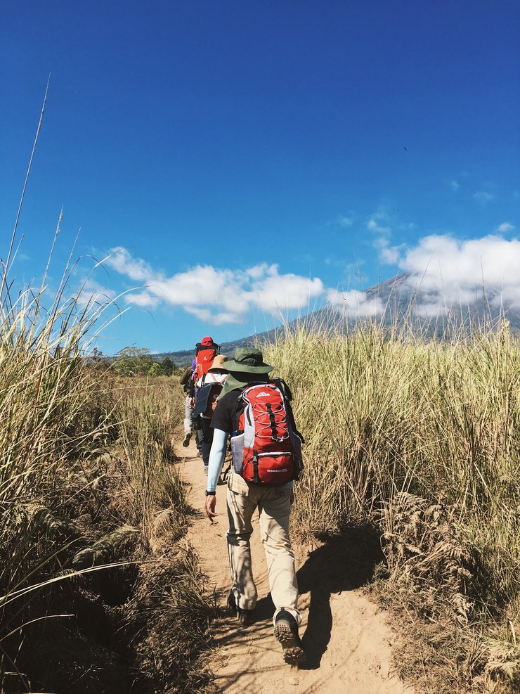
The initial phase of the trek is characterized by rolling grassy hills dotted with small trees on either side, offering no shade from larger trees. The air is hot and dusty due to foot traffic. Throughout this section, you will frequently encounter cows, which are the villagers' livestock. As you continue walking, the elevation gradually increases, and clouds begin to gather in the sky, alternating with sunshine, providing some respite from the heat.


Checkpoint I (Monitoring, 1,300 m)
First Rest Stop: At the first rest stop, there is a small pavilion built for tourists to relax. The guide gives us 10 minutes here, which is sufficient because at this early stage, the hike is not too tiring. At the rest stop, there is a small shop offering snacks and drinks to tourists, like a mini-mart in the middle of the forest. After resting, we continue our journey.
After walking for a while, the atmosphere remained the same. There were clouds alternating with sunshine, making it possible to walk without getting too hot. Our next goal was Pos II, where we would stop for lunch. This was also the last point of our journey on flat ground, as after this, the trail would begin to climb and become steeper.


Pos II (Tengengean, 1500 m) Lunch break point Someone in our group exclaimed softly. The small clump in front of us was where we would have lunch. The rest stop here has only one small pavilion, which is definitely not enough for tourists. Now, it depends on the price we paid for the tour what kind of accommodation we will get. If the price is a bit expensive, there will be a Fly Sheet spread out to protect from the sun and铺 for rest. For our group, there is only a floor cloth, which means our group will have to eat lunch in the sun. But the good thing is that the group before us just got up and left, so we were able to go in and躲避 the sun to eat lunch in the pavilion.
Upon arrival, our guide set up the cooking area at Pos II. This spot offered a lively atmosphere, with other tourists chatting and relaxing in the sun or shade. We spent a considerable amount of time here, and those who wished could explore the surroundings. However, caution was advised as the area around the accommodation served as a toilet for tourists.
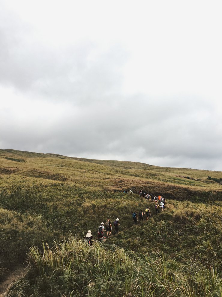
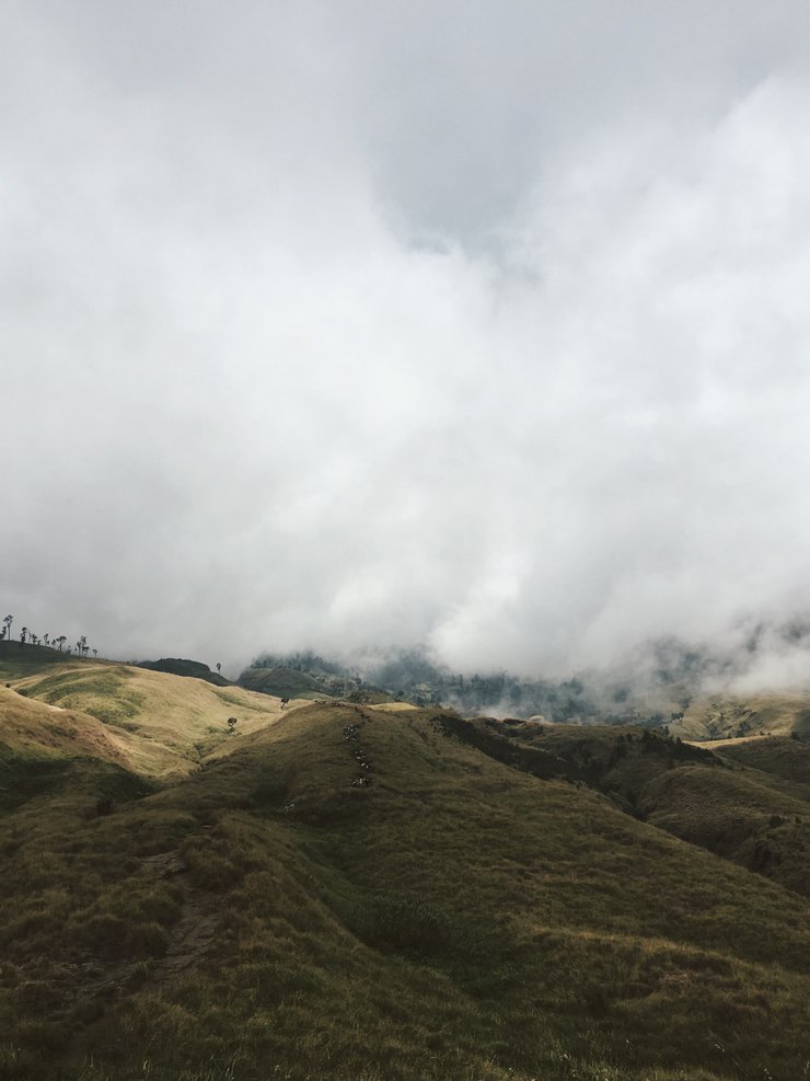
After lunch and rest, it was time to continue our journey. Our next destination was Pos III. The trail gradually ascended, and the scenery began to change. The clouds grew thicker and descended lower, creating a misty atmosphere. At times, the path felt like walking through fog. In other sections, we could observe streams of water flowing through crevices in the mountains, resembling deep ravines.


Pos III (Pada Balong, 1800 m) The last resting point is the final resting point before reaching the campsite for the night. The path after this point is steep, and at times it feels like we are climbing the edge of a mountain. There are many clouds, possibly due to the increasing altitude. The scenery on both sides is increasingly strange and beautiful. At times, clouds float by, making it difficult to see the path clearly. At other times, the sky is clear, and the sunlight shines through. This creates beautiful moments when the clouds are replaced by sunlight. The beams of light cut through the clouds, creating a magnificent spectacle.


The trail after Pos III is a true test of endurance. The steep incline and narrow path along the mountain ridge make it the most challenging section of the first day's hike. However, the breathtaking view that greets you at the end makes the arduous journey worthwhile. The fatigue fades away, replaced by a renewed sense of purpose and the motivation to continue the trek.
There it is, the peak of Rinjani. That's where we need to be tomorrow. Let's keep fighting! Hooray!


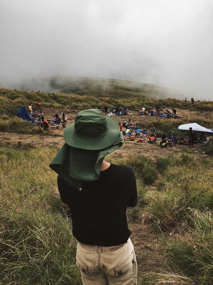
Sembalun Crater Rim (2,639 m) - Crater rim or camping spot. After a rather arduous journey, with steep slopes and a race against time to reach the summit before sunset, we were exhausted. However, the breathtaking view that greeted us at the top made it all worthwhile.
The moment we emerged from the final steep shoulder of the mountain, we exclaimed, "Wow! Why is it so beautiful?" The last rays of sunlight before sunset pierced through the edge of the crater rim, illuminating the colorful tents of the tourists against the backdrop of clouds drifting into the volcanic crater. It was a scene beyond words. We sat there, mesmerized by the view, for a long time, almost missing the opportunity to take photos as the light faded quickly. It was a truly rewarding experience after a tiring day of trekking.


The bathroom's atmosphere is beyond description.


Day 2: Sembalun Crater Rim (2,639 m) – Summit (3,726 m) – Segara Anak and Hot Springs (2008 m)
The biting cold of the August night, amplified by the strong wind, pierced through our bodies. The sky, once clear and studded with stars, had become devoid of them, as if they had migrated to the other side of the horizon. We had to wake up and prepare for our ascent to the summit of Mount Rinjani, aiming to reach the peak before sunrise to witness the first light of day from the highest point of the volcano.
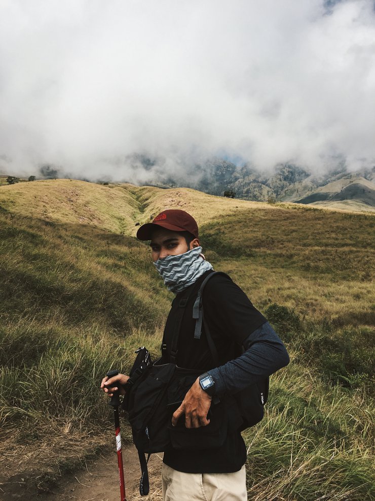
The hike was challenging due to the darkness, requiring headlamps for navigation. Visibility was limited, forcing us to follow the guide or the person in front closely. The path was dusty, with some sections being narrow and steep. The cold weather and strong winds necessitated the use of face coverings to protect against dust and the biting wind.
As dawn approached around 4:00 AM, visibility improved significantly. Previously, we could only discern shadowy figures, but now the path ahead became clearly visible. Unfortunately, by this time, our water supply had completely run out. This serves as a crucial reminder: water is essential during this hike. Many individuals have been forced to turn back before reaching the summit due to insufficient water.
Around 5:00 AM, while many people were still comfortably sleeping under their blankets, we were facing the most challenging part of our hike. The final 500 meters before reaching the summit were incredibly difficult. The path was nearly 45 degrees steep, and we had to navigate through loose soil mixed with small and large rocks. After taking just a few steps, we had to stop and rest, struggling to breathe due to the thin air at an altitude of over 2800 meters above sea level. The steepness of the path caused us to slide down, and the extreme fatigue made us incredibly sleepy. We were so tired that whenever we stopped to rest for even a moment, we would immediately fall asleep. Along the way, we saw many people napping against rocks by the side of the path.
Despite the exhaustion, we successfully conquered our inner demons and reached the summit of Mount Rinjani. This is a morning that will forever be etched in our memories.


Looking down from the left ridge, we could see other tourists walking steadily towards us. We hadn't realized how far we had come, as it was too dark to see the path while we were walking.
There is no text to translate. Please provide the text you want me to translate.


Looking down, you can see a lake in a volcanic crater and another active volcano.


The steep and dusty path necessitates the use of a face mask.

Having successfully descended from the mountain peak, we prepared to continue our journey. Our next destinations were Segara Anak Lake and the Hot Spring.


Hot Spring: As we arrived at the lake, clouds rolled in, obscuring the view. We decided to continue to the hot spring to bathe, as we hadn't encountered water for almost two days.
The hot spring is a wonderful experience. Although the water temperature is high, the cool and breezy air makes it comfortable to bathe in. The refreshing atmosphere allows for a truly enjoyable experience.


After bathing, we continued walking along the lakeshore to the tents that the porters and guides had already set up for us. As we arrived at the campsite, some of the clouds parted, revealing the peak of Rinjani on the side we had descended. It was a truly breathtaking moment, like something out of a movie.


Day 3: Segara Anak and Hot Springs (2008 m) – Senaru Crater Rim (2,641 m) – Senaru Village (601 m)
At 3:00 AM on August 13th, we began our journey to the other side of the volcanic crater rim to return. Why did we have to wake up so early? Because, according to the guide's original schedule, we were not supposed to sleep at the lake. However, since we arrived at the lake near dusk, the schedule was changed.
The journey was particularly eerie, as we had to climb the rim of a volcanic crater in near darkness. It seemed as though our group was the only one traveling at this time. Everyone walked with their heads down, barely speaking, adding to the desolate atmosphere. The wind whistling through the crater was intense, causing the large trees to sway violently and creating an eerie, howling sound.
The sun had risen above the horizon by the time we reached the Senaru Crater Rim, illuminating the surrounding landscape. The view from the rim was breathtaking, with the lake below shimmering in shades of turquoise and azure. Closer to the volcanic cone, the water took on a striking yellow hue due to the presence of sulfur, creating a mesmerizing contrast against the blue. The overall effect was one of stunning beauty.


The final descent was characterized by rolling hills covered in lush green grass, dotted with small trees. Occasional clouds provided respite from the heat.
The final stretch of the trek before reaching our destination was a dense forest, similar to a tropical rainforest in our country. The path was steep and uneven, alternating between inclines and flat sections. Our final destination was Senaru Village (601 m). Along the way, we occasionally encountered other hikers who had chosen this route as their starting point, walking in the opposite direction to our group.


At approximately 4:00 PM, we arrived at Senaru Village (601 m) after a 13-hour journey. The total trekking distance from the first day to the last day was approximately 42 kilometers. It was a very tiring trip, but apart from the fatigue, we also discovered many things from this experience. The most important thing for me was overcoming my own limitations to reach the destination.

-----------------------------------------------------
Trip Expenses
- Travel: Round-trip airfare for 4 people: 8,600 THB
- Tour: 170 USD (5,700 THB)
- Porter: 20 USD per day
-----------------------------------------------------
Note:
- Rinjani Tour: Yannick Trekker Tour
- Website: yannicktrekker.com
- Phone: +6281907664233
- Email: [email protected]
Facebook: Sangcha Travel
แสงจันทร์
Wednesday, February 26, 2025 6:50 PM